You are here: Home > Network List > TA - USArray Transportable Network (new EarthScope stations) Stations List
> Station W20A Ramah, NM, USA > Earthquake Result Viewer
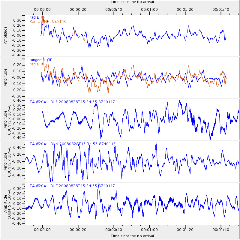
W20A Ramah, NM, USA - Earthquake Result Viewer
*The percent match for this event was below the threshold and hence no stack was calculated.
| Earthquake location: |
North Of Ascension Island |
| Earthquake latitude/longitude: |
-0.2/-17.4 |
| Earthquake time(UTC): |
2008/08/28 (241) 15:22:23 GMT |
| Earthquake Depth: |
15 km |
| Earthquake Magnitude: |
5.8 MB, 5.9 MS, 6.3 MW, 6.3 MW |
| Earthquake Catalog/Contributor: |
WHDF/NEIC |
|
| Network: |
TA USArray Transportable Network (new EarthScope stations) |
| Station: |
W20A Ramah, NM, USA |
| Lat/Lon: |
35.13 N/108.50 W |
| Elevation: |
2110 m |
|
| Distance: |
91.1 deg |
| Az: |
304.947 deg |
| Baz: |
89.547 deg |
| Ray Param: |
$rayparam |
*The percent match for this event was below the threshold and hence was not used in the summary stack. |
|
| Radial Match: |
55.743336 % |
| Radial Bump: |
400 |
| Transverse Match: |
59.08585 % |
| Transverse Bump: |
400 |
| SOD ConfigId: |
2504 |
| Insert Time: |
2010-03-06 23:05:24.716 +0000 |
| GWidth: |
2.5 |
| Max Bumps: |
400 |
| Tol: |
0.001 |
|
Signal To Noise
| Channel | StoN | STA | LTA |
| TA:W20A: :BHN:20080828T15:34:55.874011Z | 2.7810042 | 2.6445647E-7 | 9.5093874E-8 |
| TA:W20A: :BHE:20080828T15:34:55.874011Z | 0.70358306 | 6.254571E-8 | 8.889599E-8 |
| TA:W20A: :BHZ:20080828T15:34:55.874011Z | 2.5209165 | 2.4839133E-7 | 9.853215E-8 |
| Arrivals |
| Ps | |
| PpPs | |
| PsPs/PpSs | |


