You are here: Home > Network List > TA - USArray Transportable Network (new EarthScope stations) Stations List
> Station W20A Ramah, NM, USA > Earthquake Result Viewer
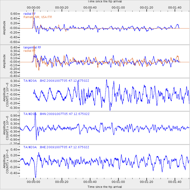
W20A Ramah, NM, USA - Earthquake Result Viewer
*The percent match for this event was below the threshold and hence no stack was calculated.
| Earthquake location: |
Rat Islands, Aleutian Islands |
| Earthquake latitude/longitude: |
52.2/178.1 |
| Earthquake time(UTC): |
2009/10/07 (280) 05:38:37 GMT |
| Earthquake Depth: |
138 km |
| Earthquake Magnitude: |
5.6 MB, 5.6 MW, 5.6 MW |
| Earthquake Catalog/Contributor: |
WHDF/NEIC |
|
| Network: |
TA USArray Transportable Network (new EarthScope stations) |
| Station: |
W20A Ramah, NM, USA |
| Lat/Lon: |
35.13 N/108.50 W |
| Elevation: |
2110 m |
|
| Distance: |
53.5 deg |
| Az: |
77.866 deg |
| Baz: |
312.711 deg |
| Ray Param: |
$rayparam |
*The percent match for this event was below the threshold and hence was not used in the summary stack. |
|
| Radial Match: |
58.291775 % |
| Radial Bump: |
310 |
| Transverse Match: |
58.810406 % |
| Transverse Bump: |
400 |
| SOD ConfigId: |
2622 |
| Insert Time: |
2010-03-06 23:05:49.571 +0000 |
| GWidth: |
2.5 |
| Max Bumps: |
400 |
| Tol: |
0.001 |
|
Signal To Noise
| Channel | StoN | STA | LTA |
| TA:W20A: :BHN:20091007T05:47:12.67502Z | 6.21823 | 4.5029026E-7 | 7.2414544E-8 |
| TA:W20A: :BHE:20091007T05:47:12.67502Z | 2.7396796 | 2.4096101E-7 | 8.7952266E-8 |
| TA:W20A: :BHZ:20091007T05:47:12.67502Z | 1.7421973 | 1.3775706E-7 | 7.907087E-8 |
| Arrivals |
| Ps | |
| PpPs | |
| PsPs/PpSs | |


