You are here: Home > Network List > TS - TERRAscope (Southern California Seismic Network) Stations List
> Station GPO China Lake , California, USA > Earthquake Result Viewer
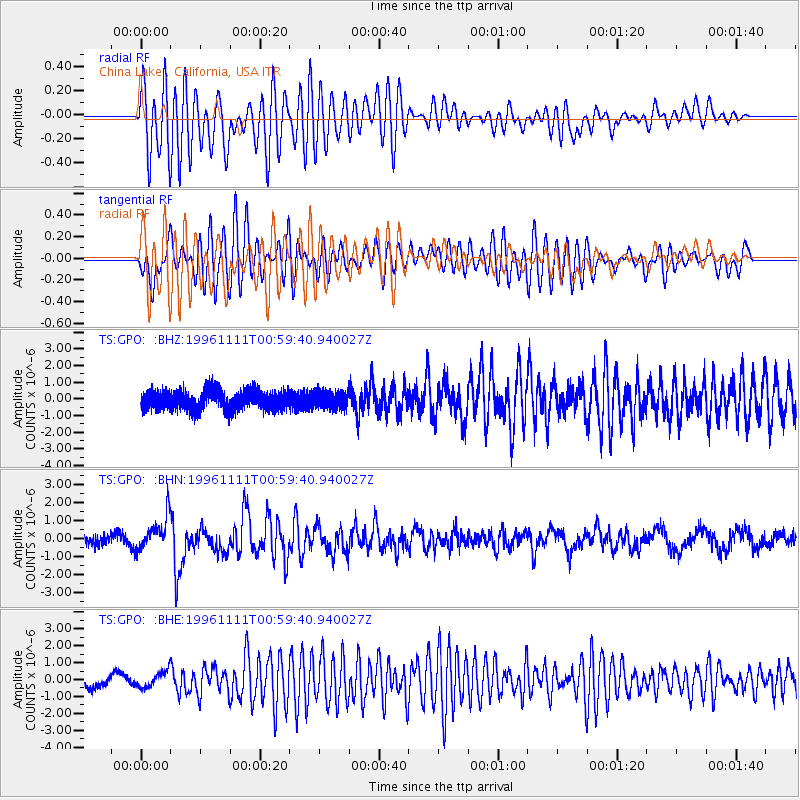
GPO China Lake , California, USA - Earthquake Result Viewer
*The percent match for this event was below the threshold and hence no stack was calculated.
| Earthquake location: |
South Of Kermadec Islands |
| Earthquake latitude/longitude: |
-32.5/-179.0 |
| Earthquake time(UTC): |
1996/11/11 (316) 00:47:21 GMT |
| Earthquake Depth: |
33 km |
| Earthquake Magnitude: |
5.9 MB, 5.9 MS, 6.1 UNKNOWN, 6.0 MW |
| Earthquake Catalog/Contributor: |
WHDF/NEIC |
|
| Network: |
TS TERRAscope (Southern California Seismic Network) |
| Station: |
GPO China Lake , California, USA |
| Lat/Lon: |
35.65 N/117.66 W |
| Elevation: |
735 m |
|
| Distance: |
88.9 deg |
| Az: |
45.652 deg |
| Baz: |
227.872 deg |
| Ray Param: |
$rayparam |
*The percent match for this event was below the threshold and hence was not used in the summary stack. |
|
| Radial Match: |
80.6841 % |
| Radial Bump: |
400 |
| Transverse Match: |
84.690285 % |
| Transverse Bump: |
400 |
| SOD ConfigId: |
4480 |
| Insert Time: |
2010-02-26 14:14:31.658 +0000 |
| GWidth: |
2.5 |
| Max Bumps: |
400 |
| Tol: |
0.001 |
|
Signal To Noise
| Channel | StoN | STA | LTA |
| TS:GPO: :BHN:19961111T00:59:40.940027Z | 3.5468497 | 9.2217175E-7 | 2.5999742E-7 |
| TS:GPO: :BHE:19961111T00:59:40.940027Z | 1.3920882 | 4.7689554E-7 | 3.4257567E-7 |
| TS:GPO: :BHZ:19961111T00:59:40.940027Z | 0.87919676 | 5.207772E-7 | 5.923329E-7 |
| Arrivals |
| Ps | |
| PpPs | |
| PsPs/PpSs | |


