You are here: Home > Network List > TS - TERRAscope (Southern California Seismic Network) Stations List
> Station GPO China Lake , California, USA > Earthquake Result Viewer
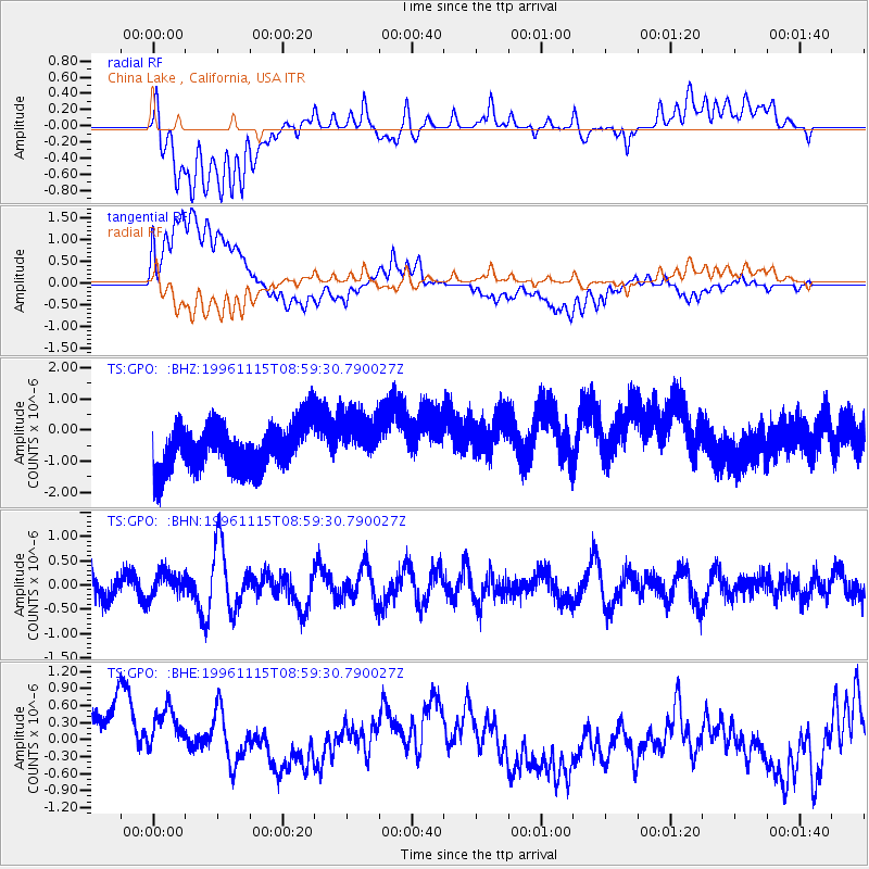
GPO China Lake , California, USA - Earthquake Result Viewer
*The percent match for this event was below the threshold and hence no stack was calculated.
| Earthquake location: |
Near Coast Of Peru |
| Earthquake latitude/longitude: |
-14.8/-75.5 |
| Earthquake time(UTC): |
1996/11/15 (320) 08:49:30 GMT |
| Earthquake Depth: |
33 km |
| Earthquake Magnitude: |
5.5 MS, 5.2 MB |
| Earthquake Catalog/Contributor: |
WHDF/NEIC |
|
| Network: |
TS TERRAscope (Southern California Seismic Network) |
| Station: |
GPO China Lake , California, USA |
| Lat/Lon: |
35.65 N/117.66 W |
| Elevation: |
735 m |
|
| Distance: |
64.1 deg |
| Az: |
322.56 deg |
| Baz: |
133.777 deg |
| Ray Param: |
$rayparam |
*The percent match for this event was below the threshold and hence was not used in the summary stack. |
|
| Radial Match: |
61.41812 % |
| Radial Bump: |
400 |
| Transverse Match: |
44.594017 % |
| Transverse Bump: |
400 |
| SOD ConfigId: |
4480 |
| Insert Time: |
2010-02-26 14:14:32.108 +0000 |
| GWidth: |
2.5 |
| Max Bumps: |
400 |
| Tol: |
0.001 |
|
Signal To Noise
| Channel | StoN | STA | LTA |
| TS:GPO: :BHN:19961115T08:59:30.790027Z | 0.87661093 | 2.5739962E-7 | 2.9363042E-7 |
| TS:GPO: :BHE:19961115T08:59:30.790027Z | 1.1022836 | 7.630132E-7 | 6.9221136E-7 |
| TS:GPO: :BHZ:19961115T08:59:30.790027Z | 1.1784236 | 8.5603057E-7 | 7.2642007E-7 |
| Arrivals |
| Ps | |
| PpPs | |
| PsPs/PpSs | |


