You are here: Home > Network List > TA - USArray Transportable Network (new EarthScope stations) Stations List
> Station W20A Ramah, NM, USA > Earthquake Result Viewer
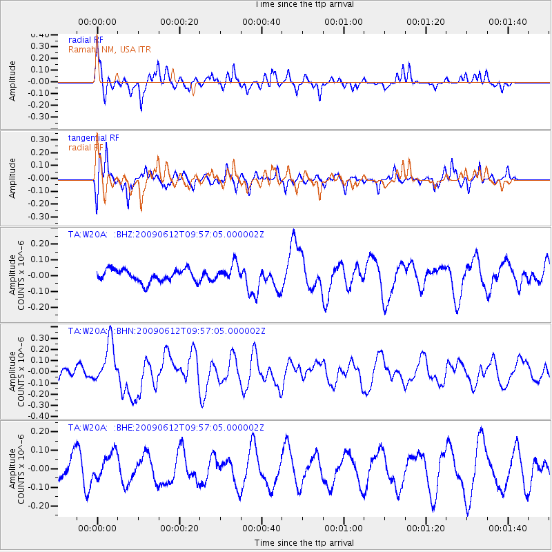
W20A Ramah, NM, USA - Earthquake Result Viewer
*The percent match for this event was below the threshold and hence no stack was calculated.
| Earthquake location: |
Vanuatu Islands |
| Earthquake latitude/longitude: |
-17.6/167.8 |
| Earthquake time(UTC): |
2009/06/12 (163) 09:44:15 GMT |
| Earthquake Depth: |
15 km |
| Earthquake Magnitude: |
5.5 MB, 5.6 MS, 6.0 MW, 6.0 MW |
| Earthquake Catalog/Contributor: |
WHDF/NEIC |
|
| Network: |
TA USArray Transportable Network (new EarthScope stations) |
| Station: |
W20A Ramah, NM, USA |
| Lat/Lon: |
35.13 N/108.50 W |
| Elevation: |
2110 m |
|
| Distance: |
95.0 deg |
| Az: |
54.864 deg |
| Baz: |
252.079 deg |
| Ray Param: |
$rayparam |
*The percent match for this event was below the threshold and hence was not used in the summary stack. |
|
| Radial Match: |
67.38287 % |
| Radial Bump: |
354 |
| Transverse Match: |
62.29218 % |
| Transverse Bump: |
400 |
| SOD ConfigId: |
2648 |
| Insert Time: |
2010-03-06 23:06:21.086 +0000 |
| GWidth: |
2.5 |
| Max Bumps: |
400 |
| Tol: |
0.001 |
|
Signal To Noise
| Channel | StoN | STA | LTA |
| TA:W20A: :BHN:20090612T09:57:05.000002Z | 3.5632262 | 1.9138318E-7 | 5.3710643E-8 |
| TA:W20A: :BHE:20090612T09:57:05.000002Z | 1.1404077 | 7.401347E-8 | 6.490088E-8 |
| TA:W20A: :BHZ:20090612T09:57:05.000002Z | 1.4514443 | 5.6482005E-8 | 3.8914344E-8 |
| Arrivals |
| Ps | |
| PpPs | |
| PsPs/PpSs | |


