You are here: Home > Network List > TS - TERRAscope (Southern California Seismic Network) Stations List
> Station GPO China Lake , California, USA > Earthquake Result Viewer
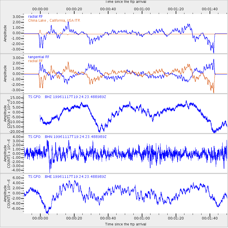
GPO China Lake , California, USA - Earthquake Result Viewer
*The percent match for this event was below the threshold and hence no stack was calculated.
| Earthquake location: |
Near Coast Of Nicaragua |
| Earthquake latitude/longitude: |
11.1/-86.1 |
| Earthquake time(UTC): |
1996/11/17 (322) 19:17:41 GMT |
| Earthquake Depth: |
33 km |
| Earthquake Magnitude: |
5.5 MB, 5.6 MS, 5.9 UNKNOWN, 5.9 MW |
| Earthquake Catalog/Contributor: |
WHDF/NEIC |
|
| Network: |
TS TERRAscope (Southern California Seismic Network) |
| Station: |
GPO China Lake , California, USA |
| Lat/Lon: |
35.65 N/117.66 W |
| Elevation: |
735 m |
|
| Distance: |
37.7 deg |
| Az: |
315.679 deg |
| Baz: |
122.64 deg |
| Ray Param: |
$rayparam |
*The percent match for this event was below the threshold and hence was not used in the summary stack. |
|
| Radial Match: |
63.951866 % |
| Radial Bump: |
394 |
| Transverse Match: |
69.47444 % |
| Transverse Bump: |
400 |
| SOD ConfigId: |
4480 |
| Insert Time: |
2010-02-26 14:14:33.496 +0000 |
| GWidth: |
2.5 |
| Max Bumps: |
400 |
| Tol: |
0.001 |
|
Signal To Noise
| Channel | StoN | STA | LTA |
| TS:GPO: :BHN:19961117T19:24:23.488989Z | 1.7982419 | 1.4092473E-6 | 7.836806E-7 |
| TS:GPO: :BHE:19961117T19:24:23.488989Z | 2.5862277 | 4.503557E-6 | 1.7413614E-6 |
| TS:GPO: :BHZ:19961117T19:24:23.488989Z | 1.3322668 | 8.801598E-6 | 6.6064827E-6 |
| Arrivals |
| Ps | |
| PpPs | |
| PsPs/PpSs | |


