You are here: Home > Network List > G - GEOSCOPE Stations List
> Station INU Inuyama, Japan > Earthquake Result Viewer
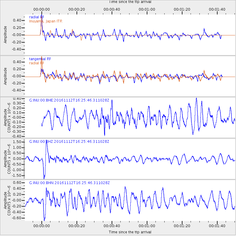
INU Inuyama, Japan - Earthquake Result Viewer
*The percent match for this event was below the threshold and hence no stack was calculated.
| Earthquake location: |
South Of Fiji Islands |
| Earthquake latitude/longitude: |
-25.0/178.7 |
| Earthquake time(UTC): |
2016/11/12 (317) 16:15:51 GMT |
| Earthquake Depth: |
565 km |
| Earthquake Magnitude: |
5.5 MB |
| Earthquake Catalog/Contributor: |
NEIC PDE/NEIC COMCAT |
|
| Network: |
G GEOSCOPE |
| Station: |
INU Inuyama, Japan |
| Lat/Lon: |
35.35 N/137.03 E |
| Elevation: |
132 m |
|
| Distance: |
71.8 deg |
| Az: |
325.127 deg |
| Baz: |
140.593 deg |
| Ray Param: |
$rayparam |
*The percent match for this event was below the threshold and hence was not used in the summary stack. |
|
| Radial Match: |
75.74832 % |
| Radial Bump: |
399 |
| Transverse Match: |
61.34112 % |
| Transverse Bump: |
385 |
| SOD ConfigId: |
1858631 |
| Insert Time: |
2016-11-28 15:44:56.851 +0000 |
| GWidth: |
2.5 |
| Max Bumps: |
400 |
| Tol: |
0.001 |
|
Signal To Noise
| Channel | StoN | STA | LTA |
| G:INU:00:BHZ:20161112T16:25:46.311028Z | 4.606441 | 8.765113E-7 | 1.9027951E-7 |
| G:INU:00:BHN:20161112T16:25:46.311028Z | 1.8170881 | 3.0667644E-7 | 1.6877357E-7 |
| G:INU:00:BHE:20161112T16:25:46.311028Z | 0.792959 | 1.013621E-7 | 1.2782766E-7 |
| Arrivals |
| Ps | |
| PpPs | |
| PsPs/PpSs | |


