You are here: Home > Network List > TA - USArray Transportable Network (new EarthScope stations) Stations List
> Station W20A Ramah, NM, USA > Earthquake Result Viewer
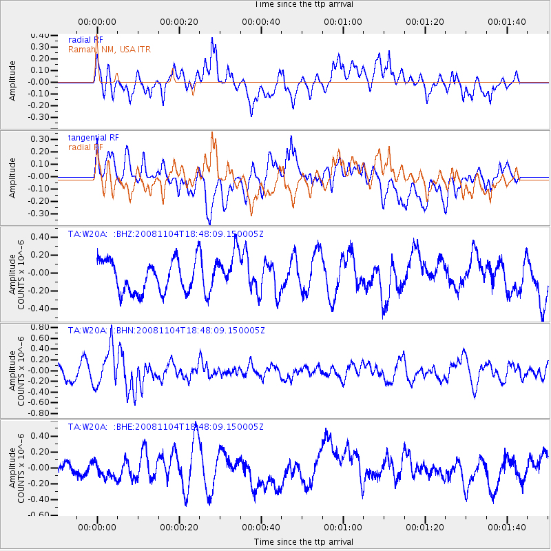
W20A Ramah, NM, USA - Earthquake Result Viewer
*The percent match for this event was below the threshold and hence no stack was calculated.
| Earthquake location: |
Vanuatu Islands |
| Earthquake latitude/longitude: |
-17.1/168.5 |
| Earthquake time(UTC): |
2008/11/04 (309) 18:35:45 GMT |
| Earthquake Depth: |
206 km |
| Earthquake Magnitude: |
5.7 MB, 6.3 MW, 6.3 MW |
| Earthquake Catalog/Contributor: |
WHDF/NEIC |
|
| Network: |
TA USArray Transportable Network (new EarthScope stations) |
| Station: |
W20A Ramah, NM, USA |
| Lat/Lon: |
35.13 N/108.50 W |
| Elevation: |
2110 m |
|
| Distance: |
94.2 deg |
| Az: |
54.669 deg |
| Baz: |
252.11 deg |
| Ray Param: |
$rayparam |
*The percent match for this event was below the threshold and hence was not used in the summary stack. |
|
| Radial Match: |
42.644215 % |
| Radial Bump: |
400 |
| Transverse Match: |
55.147713 % |
| Transverse Bump: |
400 |
| SOD ConfigId: |
2658 |
| Insert Time: |
2010-03-06 23:07:02.834 +0000 |
| GWidth: |
2.5 |
| Max Bumps: |
400 |
| Tol: |
0.001 |
|
Signal To Noise
| Channel | StoN | STA | LTA |
| TA:W20A: :BHN:20081104T18:48:09.150005Z | 3.396052 | 3.609817E-7 | 1.0629452E-7 |
| TA:W20A: :BHE:20081104T18:48:09.150005Z | 0.88601094 | 1.2931923E-7 | 1.4595669E-7 |
| TA:W20A: :BHZ:20081104T18:48:09.150005Z | 1.2750262 | 2.2560074E-7 | 1.7693812E-7 |
| Arrivals |
| Ps | |
| PpPs | |
| PsPs/PpSs | |


