You are here: Home > Network List > TA - USArray Transportable Network (new EarthScope stations) Stations List
> Station W20A Ramah, NM, USA > Earthquake Result Viewer
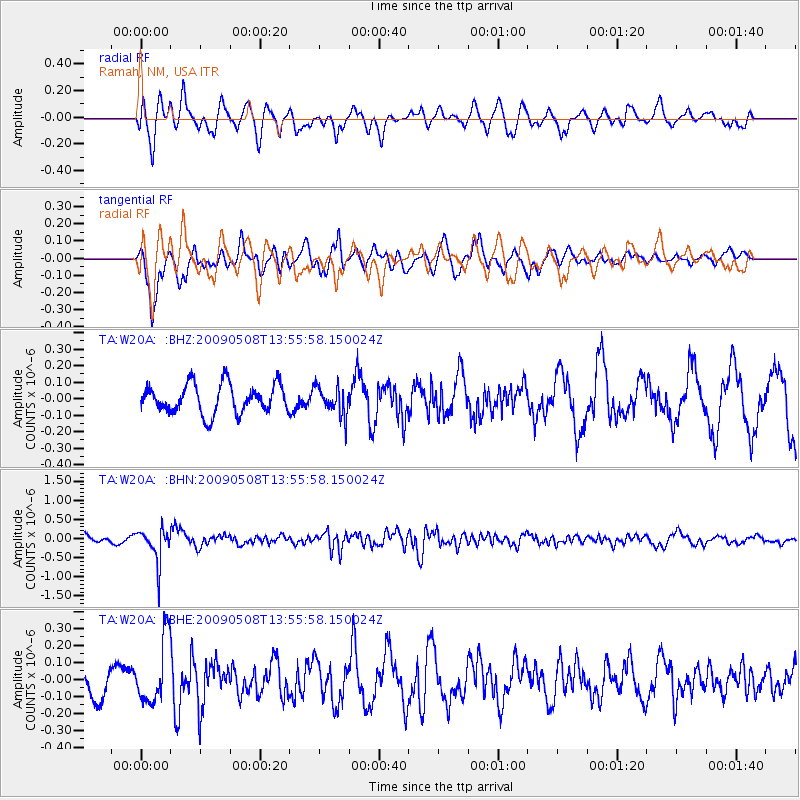
W20A Ramah, NM, USA - Earthquake Result Viewer
*The percent match for this event was below the threshold and hence no stack was calculated.
| Earthquake location: |
Mendoza Province, Argentina |
| Earthquake latitude/longitude: |
-32.1/-69.7 |
| Earthquake time(UTC): |
2009/05/08 (128) 13:44:53 GMT |
| Earthquake Depth: |
112 km |
| Earthquake Magnitude: |
5.6 MB, 5.4 MW |
| Earthquake Catalog/Contributor: |
WHDF/NEIC |
|
| Network: |
TA USArray Transportable Network (new EarthScope stations) |
| Station: |
W20A Ramah, NM, USA |
| Lat/Lon: |
35.13 N/108.50 W |
| Elevation: |
2110 m |
|
| Distance: |
76.1 deg |
| Az: |
328.041 deg |
| Baz: |
146.749 deg |
| Ray Param: |
$rayparam |
*The percent match for this event was below the threshold and hence was not used in the summary stack. |
|
| Radial Match: |
70.665115 % |
| Radial Bump: |
400 |
| Transverse Match: |
76.932106 % |
| Transverse Bump: |
400 |
| SOD ConfigId: |
2658 |
| Insert Time: |
2010-03-06 23:07:06.172 +0000 |
| GWidth: |
2.5 |
| Max Bumps: |
400 |
| Tol: |
0.001 |
|
Signal To Noise
| Channel | StoN | STA | LTA |
| TA:W20A: :BHN:20090508T13:55:58.150024Z | 4.0848284 | 4.3917873E-7 | 1.0751461E-7 |
| TA:W20A: :BHE:20090508T13:55:58.150024Z | 2.3094628 | 1.8861527E-7 | 8.167063E-8 |
| TA:W20A: :BHZ:20090508T13:55:58.150024Z | 0.99318963 | 8.733809E-8 | 8.793697E-8 |
| Arrivals |
| Ps | |
| PpPs | |
| PsPs/PpSs | |


