You are here: Home > Network List > TA - USArray Transportable Network (new EarthScope stations) Stations List
> Station W20A Ramah, NM, USA > Earthquake Result Viewer
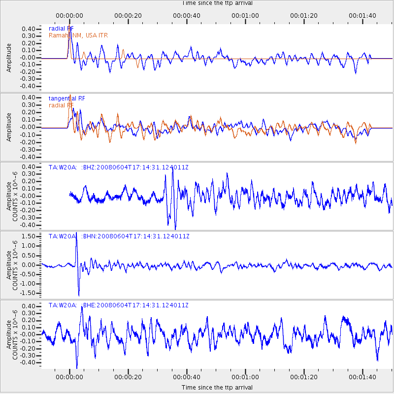
W20A Ramah, NM, USA - Earthquake Result Viewer
*The percent match for this event was below the threshold and hence no stack was calculated.
| Earthquake location: |
Hokkaido, Japan Region |
| Earthquake latitude/longitude: |
41.5/139.0 |
| Earthquake time(UTC): |
2008/06/04 (156) 17:03:07 GMT |
| Earthquake Depth: |
213 km |
| Earthquake Magnitude: |
5.5 MB, 5.7 MW, 5.7 MW |
| Earthquake Catalog/Contributor: |
WHDF/NEIC |
|
| Network: |
TA USArray Transportable Network (new EarthScope stations) |
| Station: |
W20A Ramah, NM, USA |
| Lat/Lon: |
35.13 N/108.50 W |
| Elevation: |
2110 m |
|
| Distance: |
81.8 deg |
| Az: |
49.949 deg |
| Baz: |
315.485 deg |
| Ray Param: |
$rayparam |
*The percent match for this event was below the threshold and hence was not used in the summary stack. |
|
| Radial Match: |
74.34258 % |
| Radial Bump: |
400 |
| Transverse Match: |
64.077255 % |
| Transverse Bump: |
400 |
| SOD ConfigId: |
2504 |
| Insert Time: |
2010-03-06 23:07:19.320 +0000 |
| GWidth: |
2.5 |
| Max Bumps: |
400 |
| Tol: |
0.001 |
|
Signal To Noise
| Channel | StoN | STA | LTA |
| TA:W20A: :BHN:20080604T17:14:31.124011Z | 9.584324 | 6.025786E-7 | 6.2871266E-8 |
| TA:W20A: :BHE:20080604T17:14:31.124011Z | 2.5136034 | 1.9791841E-7 | 7.8738914E-8 |
| TA:W20A: :BHZ:20080604T17:14:31.124011Z | 2.9178789 | 1.6158383E-7 | 5.5377154E-8 |
| Arrivals |
| Ps | |
| PpPs | |
| PsPs/PpSs | |


