You are here: Home > Network List > TS - TERRAscope (Southern California Seismic Network) Stations List
> Station GPO China Lake , California, USA > Earthquake Result Viewer
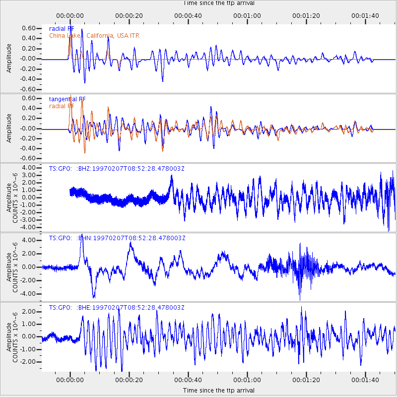
GPO China Lake , California, USA - Earthquake Result Viewer
*The percent match for this event was below the threshold and hence no stack was calculated.
| Earthquake location: |
Tonga Islands |
| Earthquake latitude/longitude: |
-19.9/-173.3 |
| Earthquake time(UTC): |
1997/02/07 (038) 08:41:13 GMT |
| Earthquake Depth: |
28 km |
| Earthquake Magnitude: |
6.0 MB, 6.2 MS, 6.4 UNKNOWN, 6.0 ME |
| Earthquake Catalog/Contributor: |
WHDF/NEIC |
|
| Network: |
TS TERRAscope (Southern California Seismic Network) |
| Station: |
GPO China Lake , California, USA |
| Lat/Lon: |
35.65 N/117.66 W |
| Elevation: |
735 m |
|
| Distance: |
76.3 deg |
| Az: |
43.782 deg |
| Baz: |
233.097 deg |
| Ray Param: |
$rayparam |
*The percent match for this event was below the threshold and hence was not used in the summary stack. |
|
| Radial Match: |
77.11724 % |
| Radial Bump: |
400 |
| Transverse Match: |
69.30359 % |
| Transverse Bump: |
400 |
| SOD ConfigId: |
4480 |
| Insert Time: |
2010-02-26 14:14:36.319 +0000 |
| GWidth: |
2.5 |
| Max Bumps: |
400 |
| Tol: |
0.001 |
|
Signal To Noise
| Channel | StoN | STA | LTA |
| TS:GPO: :BHN:19970207T08:52:28.478003Z | 6.381857 | 1.8718342E-6 | 2.9330556E-7 |
| TS:GPO: :BHE:19970207T08:52:28.478003Z | 2.0178478 | 5.575645E-7 | 2.7631646E-7 |
| TS:GPO: :BHZ:19970207T08:52:28.478003Z | 1.6566765 | 1.0489048E-6 | 6.331379E-7 |
| Arrivals |
| Ps | |
| PpPs | |
| PsPs/PpSs | |


