You are here: Home > Network List > TA - USArray Transportable Network (new EarthScope stations) Stations List
> Station Y21A Point of Rocks Canyon, Magdalena, NM, USA > Earthquake Result Viewer
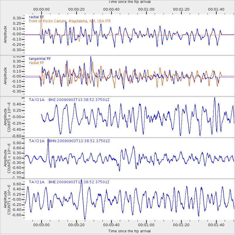
Y21A Point of Rocks Canyon, Magdalena, NM, USA - Earthquake Result Viewer
*The percent match for this event was below the threshold and hence no stack was calculated.
| Earthquake location: |
Kyushu, Japan |
| Earthquake latitude/longitude: |
31.1/130.0 |
| Earthquake time(UTC): |
2009/09/03 (246) 13:26:18 GMT |
| Earthquake Depth: |
166 km |
| Earthquake Magnitude: |
5.9 MB, 6.2 MW, 6.2 MW |
| Earthquake Catalog/Contributor: |
WHDF/NEIC |
|
| Network: |
TA USArray Transportable Network (new EarthScope stations) |
| Station: |
Y21A Point of Rocks Canyon, Magdalena, NM, USA |
| Lat/Lon: |
34.01 N/107.67 W |
| Elevation: |
2168 m |
|
| Distance: |
95.4 deg |
| Az: |
44.851 deg |
| Baz: |
313.284 deg |
| Ray Param: |
$rayparam |
*The percent match for this event was below the threshold and hence was not used in the summary stack. |
|
| Radial Match: |
40.285225 % |
| Radial Bump: |
378 |
| Transverse Match: |
50.83418 % |
| Transverse Bump: |
383 |
| SOD ConfigId: |
2622 |
| Insert Time: |
2010-03-06 23:09:56.607 +0000 |
| GWidth: |
2.5 |
| Max Bumps: |
400 |
| Tol: |
0.001 |
|
Signal To Noise
| Channel | StoN | STA | LTA |
| TA:Y21A: :BHN:20090903T13:38:52.37501Z | 3.0477004 | 3.9165766E-7 | 1.2850924E-7 |
| TA:Y21A: :BHE:20090903T13:38:52.37501Z | 1.4161023 | 3.0590684E-7 | 2.160203E-7 |
| TA:Y21A: :BHZ:20090903T13:38:52.37501Z | 0.761914 | 1.8207922E-7 | 2.3897607E-7 |
| Arrivals |
| Ps | |
| PpPs | |
| PsPs/PpSs | |


