You are here: Home > Network List > GS - US Geological Survey Networks Stations List
> Station KAN13 Rinehart Farm > Earthquake Result Viewer
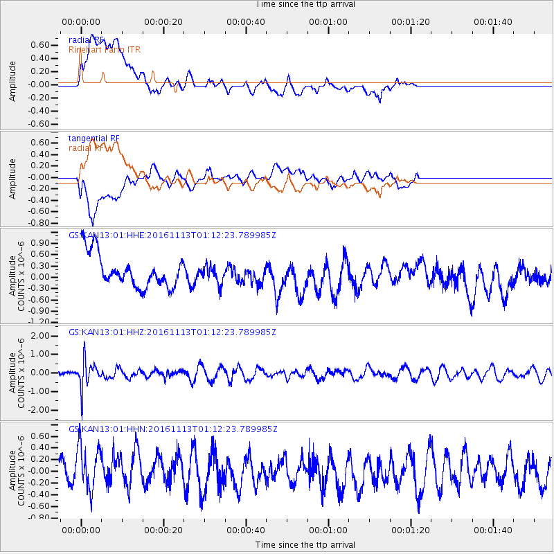
KAN13 Rinehart Farm - Earthquake Result Viewer
*The percent match for this event was below the threshold and hence no stack was calculated.
| Earthquake location: |
La Rioja Province, Argentina |
| Earthquake latitude/longitude: |
-28.1/-67.3 |
| Earthquake time(UTC): |
2016/11/13 (318) 01:01:51 GMT |
| Earthquake Depth: |
121 km |
| Earthquake Magnitude: |
5.7 MB |
| Earthquake Catalog/Contributor: |
NEIC PDE/NEIC COMCAT |
|
| Network: |
GS US Geological Survey Networks |
| Station: |
KAN13 Rinehart Farm |
| Lat/Lon: |
37.01 N/97.48 W |
| Elevation: |
340 m |
|
| Distance: |
70.7 deg |
| Az: |
334.785 deg |
| Baz: |
151.953 deg |
| Ray Param: |
$rayparam |
*The percent match for this event was below the threshold and hence was not used in the summary stack. |
|
| Radial Match: |
39.16418 % |
| Radial Bump: |
400 |
| Transverse Match: |
56.021603 % |
| Transverse Bump: |
400 |
| SOD ConfigId: |
1858631 |
| Insert Time: |
2016-11-28 15:49:04.143 +0000 |
| GWidth: |
2.5 |
| Max Bumps: |
400 |
| Tol: |
0.001 |
|
Signal To Noise
| Channel | StoN | STA | LTA |
| GS:KAN13:01:HHZ:20161113T01:12:23.789985Z | 2.9006116 | 7.7624475E-7 | 2.6761418E-7 |
| GS:KAN13:01:HHN:20161113T01:12:23.789985Z | 1.5261337 | 4.7999725E-7 | 3.145185E-7 |
| GS:KAN13:01:HHE:20161113T01:12:23.789985Z | 0.5502894 | 2.3956582E-7 | 4.3534513E-7 |
| Arrivals |
| Ps | |
| PpPs | |
| PsPs/PpSs | |


