You are here: Home > Network List > TA - USArray Transportable Network (new EarthScope stations) Stations List
> Station Y21A Point of Rocks Canyon, Magdalena, NM, USA > Earthquake Result Viewer
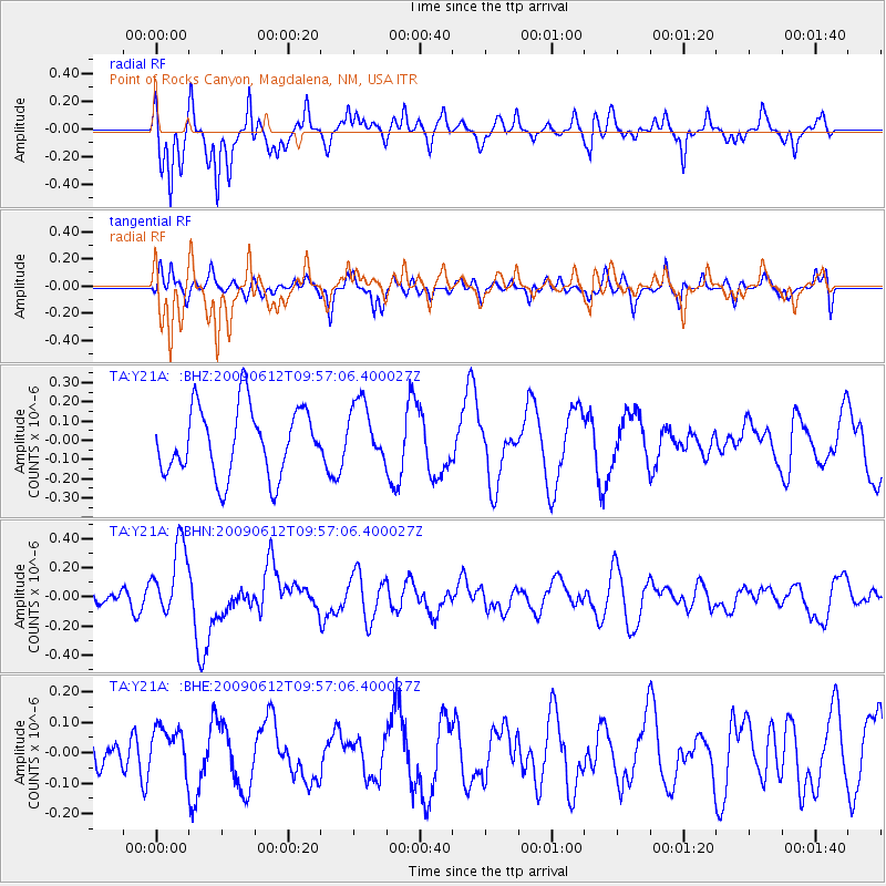
Y21A Point of Rocks Canyon, Magdalena, NM, USA - Earthquake Result Viewer
*The percent match for this event was below the threshold and hence no stack was calculated.
| Earthquake location: |
Vanuatu Islands |
| Earthquake latitude/longitude: |
-17.6/167.8 |
| Earthquake time(UTC): |
2009/06/12 (163) 09:44:15 GMT |
| Earthquake Depth: |
15 km |
| Earthquake Magnitude: |
5.5 MB, 5.6 MS, 6.0 MW, 6.0 MW |
| Earthquake Catalog/Contributor: |
WHDF/NEIC |
|
| Network: |
TA USArray Transportable Network (new EarthScope stations) |
| Station: |
Y21A Point of Rocks Canyon, Magdalena, NM, USA |
| Lat/Lon: |
34.01 N/107.67 W |
| Elevation: |
2168 m |
|
| Distance: |
95.3 deg |
| Az: |
56.138 deg |
| Baz: |
252.432 deg |
| Ray Param: |
$rayparam |
*The percent match for this event was below the threshold and hence was not used in the summary stack. |
|
| Radial Match: |
68.036095 % |
| Radial Bump: |
400 |
| Transverse Match: |
63.52783 % |
| Transverse Bump: |
400 |
| SOD ConfigId: |
2648 |
| Insert Time: |
2010-03-06 23:10:25.206 +0000 |
| GWidth: |
2.5 |
| Max Bumps: |
400 |
| Tol: |
0.001 |
|
Signal To Noise
| Channel | StoN | STA | LTA |
| TA:Y21A: :BHN:20090612T09:57:06.400027Z | 4.308776 | 2.502842E-7 | 5.808708E-8 |
| TA:Y21A: :BHE:20090612T09:57:06.400027Z | 1.1064125 | 7.501343E-8 | 6.7798794E-8 |
| TA:Y21A: :BHZ:20090612T09:57:06.400027Z | 0.89771533 | 1.595403E-7 | 1.7771815E-7 |
| Arrivals |
| Ps | |
| PpPs | |
| PsPs/PpSs | |


