You are here: Home > Network List > TA - USArray Transportable Network (new EarthScope stations) Stations List
> Station I30M Mount Dempster, Yukon, CAN > Earthquake Result Viewer
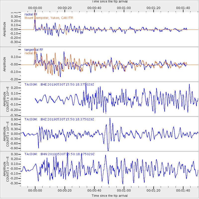
I30M Mount Dempster, Yukon, CAN - Earthquake Result Viewer
*The percent match for this event was below the threshold and hence no stack was calculated.
| Earthquake location: |
Fiji Islands Region |
| Earthquake latitude/longitude: |
-21.8/-176.3 |
| Earthquake time(UTC): |
2019/05/30 (150) 15:38:00 GMT |
| Earthquake Depth: |
169 km |
| Earthquake Magnitude: |
5.8 Mww |
| Earthquake Catalog/Contributor: |
NEIC PDE/us |
|
| Network: |
TA USArray Transportable Network (new EarthScope stations) |
| Station: |
I30M Mount Dempster, Yukon, CAN |
| Lat/Lon: |
65.22 N/136.38 W |
| Elevation: |
1399 m |
|
| Distance: |
91.9 deg |
| Az: |
15.703 deg |
| Baz: |
216.653 deg |
| Ray Param: |
$rayparam |
*The percent match for this event was below the threshold and hence was not used in the summary stack. |
|
| Radial Match: |
59.416313 % |
| Radial Bump: |
400 |
| Transverse Match: |
61.6987 % |
| Transverse Bump: |
400 |
| SOD ConfigId: |
18369291 |
| Insert Time: |
2019-06-13 15:44:40.485 +0000 |
| GWidth: |
2.5 |
| Max Bumps: |
400 |
| Tol: |
0.001 |
|
Signal To Noise
| Channel | StoN | STA | LTA |
| TA:I30M: :BHZ:20190530T15:50:18.375029Z | 5.924103 | 3.0530893E-7 | 5.1536738E-8 |
| TA:I30M: :BHN:20190530T15:50:18.375029Z | 2.3710473 | 1.0351507E-7 | 4.3657955E-8 |
| TA:I30M: :BHE:20190530T15:50:18.375029Z | 2.5021129 | 1.01866256E-7 | 4.0712095E-8 |
| Arrivals |
| Ps | |
| PpPs | |
| PsPs/PpSs | |


