You are here: Home > Network List > TA - USArray Transportable Network (new EarthScope stations) Stations List
> Station Y21A Point of Rocks Canyon, Magdalena, NM, USA > Earthquake Result Viewer
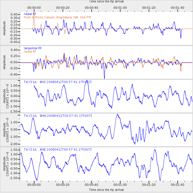
Y21A Point of Rocks Canyon, Magdalena, NM, USA - Earthquake Result Viewer
*The percent match for this event was below the threshold and hence no stack was calculated.
| Earthquake location: |
Kuril Islands |
| Earthquake latitude/longitude: |
43.9/147.5 |
| Earthquake time(UTC): |
2008/04/12 (103) 00:46:28 GMT |
| Earthquake Depth: |
64 km |
| Earthquake Magnitude: |
5.7 MB |
| Earthquake Catalog/Contributor: |
WHDF/NEIC |
|
| Network: |
TA USArray Transportable Network (new EarthScope stations) |
| Station: |
Y21A Point of Rocks Canyon, Magdalena, NM, USA |
| Lat/Lon: |
34.01 N/107.67 W |
| Elevation: |
2168 m |
|
| Distance: |
76.7 deg |
| Az: |
55.622 deg |
| Baz: |
314.072 deg |
| Ray Param: |
$rayparam |
*The percent match for this event was below the threshold and hence was not used in the summary stack. |
|
| Radial Match: |
50.599934 % |
| Radial Bump: |
361 |
| Transverse Match: |
45.8947 % |
| Transverse Bump: |
374 |
| SOD ConfigId: |
2504 |
| Insert Time: |
2010-03-06 23:10:48.136 +0000 |
| GWidth: |
2.5 |
| Max Bumps: |
400 |
| Tol: |
0.001 |
|
Signal To Noise
| Channel | StoN | STA | LTA |
| TA:Y21A: :BHN:20080412T00:57:41.175007Z | 1.7294011 | 9.4924354E-7 | 5.488857E-7 |
| TA:Y21A: :BHE:20080412T00:57:41.175007Z | 2.002552 | 1.0602643E-6 | 5.2945654E-7 |
| TA:Y21A: :BHZ:20080412T00:57:41.175007Z | 0.9768391 | 4.7226504E-7 | 4.8346243E-7 |
| Arrivals |
| Ps | |
| PpPs | |
| PsPs/PpSs | |


