You are here: Home > Network List > TA - USArray Transportable Network (new EarthScope stations) Stations List
> Station R33M Jennings River, BC, CAN > Earthquake Result Viewer
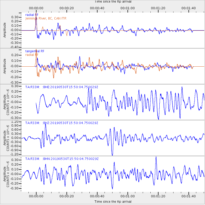
R33M Jennings River, BC, CAN - Earthquake Result Viewer
*The percent match for this event was below the threshold and hence no stack was calculated.
| Earthquake location: |
Fiji Islands Region |
| Earthquake latitude/longitude: |
-21.8/-176.3 |
| Earthquake time(UTC): |
2019/05/30 (150) 15:38:00 GMT |
| Earthquake Depth: |
169 km |
| Earthquake Magnitude: |
5.8 Mww |
| Earthquake Catalog/Contributor: |
NEIC PDE/us |
|
| Network: |
TA USArray Transportable Network (new EarthScope stations) |
| Station: |
R33M Jennings River, BC, CAN |
| Lat/Lon: |
59.39 N/130.97 W |
| Elevation: |
1437 m |
|
| Distance: |
89.0 deg |
| Az: |
21.346 deg |
| Baz: |
221.396 deg |
| Ray Param: |
$rayparam |
*The percent match for this event was below the threshold and hence was not used in the summary stack. |
|
| Radial Match: |
73.09444 % |
| Radial Bump: |
400 |
| Transverse Match: |
65.88419 % |
| Transverse Bump: |
400 |
| SOD ConfigId: |
18369291 |
| Insert Time: |
2019-06-13 15:45:32.249 +0000 |
| GWidth: |
2.5 |
| Max Bumps: |
400 |
| Tol: |
0.001 |
|
Signal To Noise
| Channel | StoN | STA | LTA |
| TA:R33M: :BHZ:20190530T15:50:04.750029Z | 2.8678515 | 2.695255E-7 | 9.3981676E-8 |
| TA:R33M: :BHN:20190530T15:50:04.750029Z | 1.283942 | 8.197114E-8 | 6.384334E-8 |
| TA:R33M: :BHE:20190530T15:50:04.750029Z | 1.4791708 | 1.1593203E-7 | 7.837637E-8 |
| Arrivals |
| Ps | |
| PpPs | |
| PsPs/PpSs | |


