You are here: Home > Network List > TA - USArray Transportable Network (new EarthScope stations) Stations List
> Station Y21A Point of Rocks Canyon, Magdalena, NM, USA > Earthquake Result Viewer
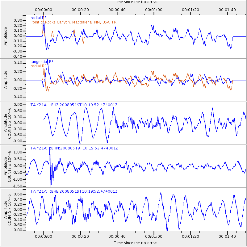
Y21A Point of Rocks Canyon, Magdalena, NM, USA - Earthquake Result Viewer
*The percent match for this event was below the threshold and hence no stack was calculated.
| Earthquake location: |
E. Russia-N.E. China Border Reg. |
| Earthquake latitude/longitude: |
42.5/131.9 |
| Earthquake time(UTC): |
2008/05/19 (140) 10:08:36 GMT |
| Earthquake Depth: |
513 km |
| Earthquake Magnitude: |
5.7 MW, 5.4 MB, 5.6 MW |
| Earthquake Catalog/Contributor: |
WHDF/NEIC |
|
| Network: |
TA USArray Transportable Network (new EarthScope stations) |
| Station: |
Y21A Point of Rocks Canyon, Magdalena, NM, USA |
| Lat/Lon: |
34.01 N/107.67 W |
| Elevation: |
2168 m |
|
| Distance: |
86.4 deg |
| Az: |
45.851 deg |
| Baz: |
320.301 deg |
| Ray Param: |
$rayparam |
*The percent match for this event was below the threshold and hence was not used in the summary stack. |
|
| Radial Match: |
63.61987 % |
| Radial Bump: |
400 |
| Transverse Match: |
70.624176 % |
| Transverse Bump: |
289 |
| SOD ConfigId: |
2504 |
| Insert Time: |
2010-03-06 23:11:27.780 +0000 |
| GWidth: |
2.5 |
| Max Bumps: |
400 |
| Tol: |
0.001 |
|
Signal To Noise
| Channel | StoN | STA | LTA |
| TA:Y21A: :BHN:20080519T10:19:52.474001Z | 1.9904811 | 5.803205E-7 | 2.9154785E-7 |
| TA:Y21A: :BHE:20080519T10:19:52.474001Z | 1.4873549 | 2.907498E-7 | 1.9548112E-7 |
| TA:Y21A: :BHZ:20080519T10:19:52.474001Z | 1.1039675 | 5.340052E-7 | 4.837146E-7 |
| Arrivals |
| Ps | |
| PpPs | |
| PsPs/PpSs | |


