You are here: Home > Network List > TS - TERRAscope (Southern California Seismic Network) Stations List
> Station GPO China Lake , California, USA > Earthquake Result Viewer
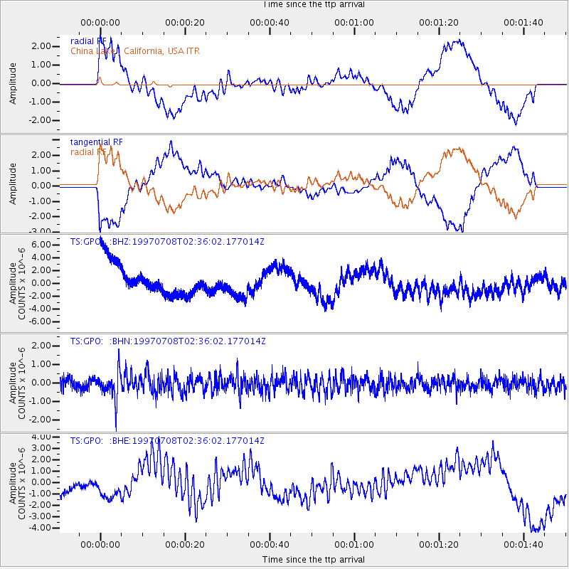
GPO China Lake , California, USA - Earthquake Result Viewer
*The percent match for this event was below the threshold and hence no stack was calculated.
| Earthquake location: |
Volcano Islands, Japan Region |
| Earthquake latitude/longitude: |
23.8/142.7 |
| Earthquake time(UTC): |
1997/07/08 (189) 02:24:07 GMT |
| Earthquake Depth: |
33 km |
| Earthquake Magnitude: |
5.8 MB, 5.6 MS, 5.9 UNKNOWN, 5.8 MW |
| Earthquake Catalog/Contributor: |
WHDF/NEIC |
|
| Network: |
TS TERRAscope (Southern California Seismic Network) |
| Station: |
GPO China Lake , California, USA |
| Lat/Lon: |
35.65 N/117.66 W |
| Elevation: |
735 m |
|
| Distance: |
83.8 deg |
| Az: |
53.867 deg |
| Baz: |
294.725 deg |
| Ray Param: |
$rayparam |
*The percent match for this event was below the threshold and hence was not used in the summary stack. |
|
| Radial Match: |
49.37173 % |
| Radial Bump: |
400 |
| Transverse Match: |
45.671543 % |
| Transverse Bump: |
400 |
| SOD ConfigId: |
4480 |
| Insert Time: |
2010-02-26 14:14:43.703 +0000 |
| GWidth: |
2.5 |
| Max Bumps: |
400 |
| Tol: |
0.001 |
|
Signal To Noise
| Channel | StoN | STA | LTA |
| TS:GPO: :BHN:19970708T02:36:02.177014Z | 2.539397 | 7.0238605E-7 | 2.765956E-7 |
| TS:GPO: :BHE:19970708T02:36:02.177014Z | 0.89562935 | 1.2691212E-6 | 1.417016E-6 |
| TS:GPO: :BHZ:19970708T02:36:02.177014Z | 0.9272578 | 2.2082866E-6 | 2.381524E-6 |
| Arrivals |
| Ps | |
| PpPs | |
| PsPs/PpSs | |


