You are here: Home > Network List > TA - USArray Transportable Network (new EarthScope stations) Stations List
> Station F21K Alatna River, AK, USA > Earthquake Result Viewer
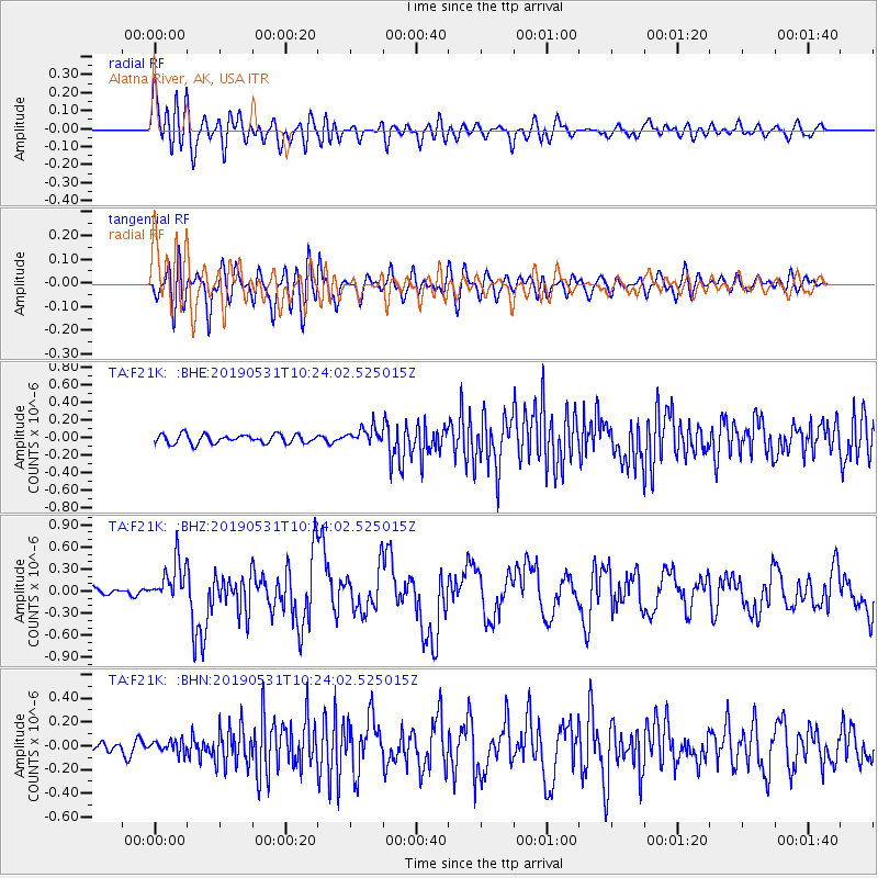
F21K Alatna River, AK, USA - Earthquake Result Viewer
*The percent match for this event was below the threshold and hence no stack was calculated.
| Earthquake location: |
Mindanao, Philippines |
| Earthquake latitude/longitude: |
6.3/126.6 |
| Earthquake time(UTC): |
2019/05/31 (151) 10:12:32 GMT |
| Earthquake Depth: |
90 km |
| Earthquake Magnitude: |
6.1 Mww |
| Earthquake Catalog/Contributor: |
NEIC PDE/us |
|
| Network: |
TA USArray Transportable Network (new EarthScope stations) |
| Station: |
F21K Alatna River, AK, USA |
| Lat/Lon: |
67.22 N/153.48 W |
| Elevation: |
597 m |
|
| Distance: |
80.4 deg |
| Az: |
22.886 deg |
| Baz: |
263.164 deg |
| Ray Param: |
$rayparam |
*The percent match for this event was below the threshold and hence was not used in the summary stack. |
|
| Radial Match: |
78.812584 % |
| Radial Bump: |
400 |
| Transverse Match: |
69.54628 % |
| Transverse Bump: |
400 |
| SOD ConfigId: |
18369291 |
| Insert Time: |
2019-06-14 10:16:43.476 +0000 |
| GWidth: |
2.5 |
| Max Bumps: |
400 |
| Tol: |
0.001 |
|
Signal To Noise
| Channel | StoN | STA | LTA |
| TA:F21K: :BHZ:20190531T10:24:02.525015Z | 4.27526 | 2.7945907E-7 | 6.536657E-8 |
| TA:F21K: :BHN:20190531T10:24:02.525015Z | 1.3258418 | 4.9947936E-8 | 3.7672624E-8 |
| TA:F21K: :BHE:20190531T10:24:02.525015Z | 1.8765355 | 9.3494535E-8 | 4.9822948E-8 |
| Arrivals |
| Ps | |
| PpPs | |
| PsPs/PpSs | |


