You are here: Home > Network List > TS - TERRAscope (Southern California Seismic Network) Stations List
> Station GPO China Lake , California, USA > Earthquake Result Viewer
GPO China Lake , California, USA - Earthquake Result Viewer
*The percent match for this event was below the threshold and hence no stack was calculated.
| Earthquake location: |
Easter Island Region |
| Earthquake latitude/longitude: |
-22.1/-113.1 |
| Earthquake time(UTC): |
1996/09/05 (249) 09:10:20 GMT |
| Earthquake Depth: |
10 km |
| Earthquake Magnitude: |
5.6 MB, 6.3 MS |
| Earthquake Catalog/Contributor: |
WHDF/NEIC |
|
| Network: |
TS TERRAscope (Southern California Seismic Network) |
| Station: |
GPO China Lake , California, USA |
| Lat/Lon: |
35.65 N/117.66 W |
| Elevation: |
735 m |
|
| Distance: |
57.6 deg |
| Az: |
355.596 deg |
| Baz: |
174.983 deg |
| Ray Param: |
$rayparam |
*The percent match for this event was below the threshold and hence was not used in the summary stack. |
|
| Radial Match: |
56.039944 % |
| Radial Bump: |
400 |
| Transverse Match: |
41.947384 % |
| Transverse Bump: |
400 |
| SOD ConfigId: |
4480 |
| Insert Time: |
2010-02-26 14:14:46.729 +0000 |
| GWidth: |
2.5 |
| Max Bumps: |
400 |
| Tol: |
0.001 |
|
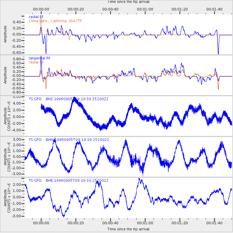
Signal To Noise
| Channel | StoN | STA | LTA |
| TS:GPO: :BHN:19960905T09:19:39.252002Z | 1.5935969 | 1.5023311E-6 | 9.427296E-7 |
| TS:GPO: :BHE:19960905T09:19:39.252002Z | 0.4506867 | 6.1442057E-7 | 1.3632987E-6 |
| TS:GPO: :BHZ:19960905T09:19:39.252002Z | 1.9872714 | 4.17435E-6 | 2.1005437E-6 |
| Arrivals |
| Ps | |
| PpPs | |
| PsPs/PpSs | |


