You are here: Home > Network List > TA - USArray Transportable Network (new EarthScope stations) Stations List
> Station 120A U Bar Ranch, Lordsburg, NM, USA > Earthquake Result Viewer
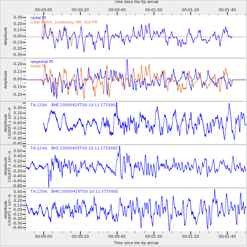
120A U Bar Ranch, Lordsburg, NM, USA - Earthquake Result Viewer
*The percent match for this event was below the threshold and hence no stack was calculated.
| Earthquake location: |
Kermadec Islands, New Zealand |
| Earthquake latitude/longitude: |
-30.3/-178.6 |
| Earthquake time(UTC): |
2009/04/26 (116) 00:06:53 GMT |
| Earthquake Depth: |
132 km |
| Earthquake Magnitude: |
5.5 MB, 6.1 MW, 6.1 MW |
| Earthquake Catalog/Contributor: |
WHDF/NEIC |
|
| Network: |
TA USArray Transportable Network (new EarthScope stations) |
| Station: |
120A U Bar Ranch, Lordsburg, NM, USA |
| Lat/Lon: |
32.55 N/108.63 W |
| Elevation: |
1528 m |
|
| Distance: |
91.1 deg |
| Az: |
52.516 deg |
| Baz: |
234.349 deg |
| Ray Param: |
$rayparam |
*The percent match for this event was below the threshold and hence was not used in the summary stack. |
|
| Radial Match: |
63.56602 % |
| Radial Bump: |
400 |
| Transverse Match: |
64.767166 % |
| Transverse Bump: |
400 |
| SOD ConfigId: |
2658 |
| Insert Time: |
2010-03-06 23:14:30.672 +0000 |
| GWidth: |
2.5 |
| Max Bumps: |
400 |
| Tol: |
0.001 |
|
Signal To Noise
| Channel | StoN | STA | LTA |
| TA:120A: :BHZ:20090426T00:19:11.373999Z | 3.5811734 | 2.556413E-7 | 7.138479E-8 |
| TA:120A: :BHN:20090426T00:19:11.373999Z | 1.382848 | 1.2259292E-7 | 8.865249E-8 |
| TA:120A: :BHE:20090426T00:19:11.373999Z | 0.86818385 | 1.0232151E-7 | 1.17856956E-7 |
| Arrivals |
| Ps | |
| PpPs | |
| PsPs/PpSs | |


