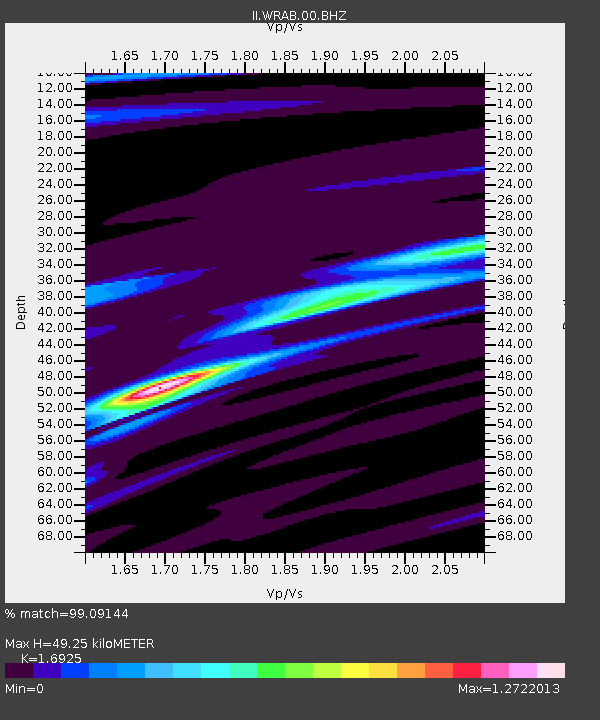
WRAB Tennant Creek, NT, Australia - Earthquake Result Viewer
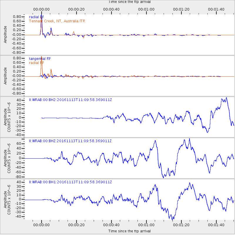
Earthquake location: South Island, New Zealand
Earthquake latitude/longitude: -42.7/173.1
Earthquake time(UTC): 2016/11/13 (318) 11:02:59 GMT
Earthquake Depth: 22 km
Earthquake Magnitude: 7.8 MWW, 7.2 MWB, 7.4 MI, 7.8 MWC
Earthquake Catalog/Contributor: NEIC PDE/NEIC COMCAT
Network: II Global Seismograph Network (GSN - IRIS/IDA)
Station: WRAB Tennant Creek, NT, Australia
Lat/Lon: 19.93 S/134.36 E
Elevation: 366 m
Distance: 39.6 deg
Az: 292.742 deg
Baz: 133.751 deg
Ray Param: 0.0748404
Estimated Moho Depth: 49.25 km
Estimated Crust Vp/Vs: 1.69
Assumed Crust Vp: 6.642 km/s
Estimated Crust Vs: 3.924 km/s
Estimated Crust Poisson's Ratio: 0.23
Radial Match: 99.09144 %
Radial Bump: 184
Transverse Match: 84.15738 %
Transverse Bump: 400
SOD ConfigId: 1858631
Insert Time: 2016-11-28 15:54:24.064 +0000
GWidth: 2.5
Max Bumps: 400
Tol: 0.001

Signal To Noise

ChannelStoNSTALTA
II:WRAB:00:BHZ:20161113T11:09:58.369011Z5.51029731.2899169E-62.3409206E-7
II:WRAB:00:BH1:20161113T11:09:58.369011Z3.48580177.1312064E-72.0457867E-7
II:WRAB:00:BH2:20161113T11:09:58.369011Z4.0883186.87626E-71.6819288E-7
Arrivals
Ps5.6 SECOND
PpPs18 SECOND
PsPs/PpSs24 SECOND