PMG Port Moresby, New Guinea - Earthquake Result Viewer
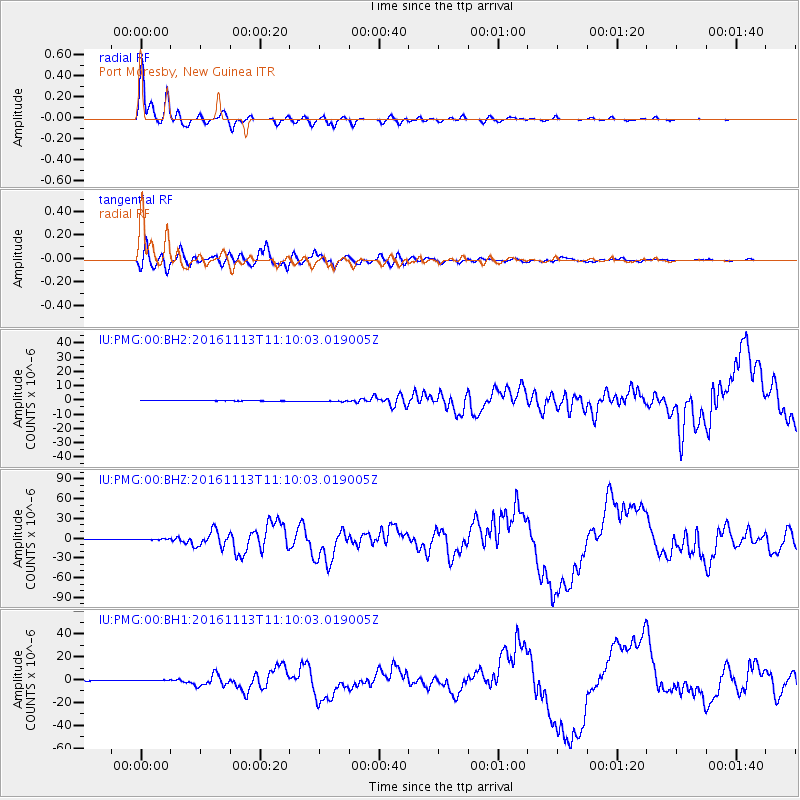
Earthquake location: South Island, New Zealand
Earthquake latitude/longitude: -42.7/173.1
Earthquake time(UTC): 2016/11/13 (318) 11:02:59 GMT
Earthquake Depth: 22 km
Earthquake Magnitude: 7.8 MWW, 7.2 MWB, 7.4 MI, 7.8 MWC
Earthquake Catalog/Contributor: NEIC PDE/NEIC COMCAT
Network: IU Global Seismograph Network (GSN - IRIS/USGS)
Station: PMG Port Moresby, New Guinea
Lat/Lon: 9.40 S/147.16 E
Elevation: 90 m
Distance: 40.2 deg
Az: 318.097 deg
Baz: 150.082 deg
Ray Param: 0.07450176
Estimated Moho Depth: 28.75 km
Estimated Crust Vp/Vs: 1.89
Assumed Crust Vp: 6.122 km/s
Estimated Crust Vs: 3.235 km/s
Estimated Crust Poisson's Ratio: 0.31
Radial Match: 98.86484 %
Radial Bump: 312
Transverse Match: 92.50083 %
Transverse Bump: 400
SOD ConfigId: 1858631
Insert Time: 2016-11-28 15:54:37.660 +0000
GWidth: 2.5
Max Bumps: 400
Tol: 0.001

Signal To Noise

ChannelStoNSTALTA
IU:PMG:00:BHZ:20161113T11:10:03.019005Z6.8787999.940545E-71.445099E-7
IU:PMG:00:BH1:20161113T11:10:03.019005Z3.86095295.644668E-71.4619883E-7
IU:PMG:00:BH2:20161113T11:10:03.019005Z3.604473.4308198E-79.5182365E-8
Arrivals
Ps4.4 SECOND
PpPs13 SECOND
PsPs/PpSs17 SECOND