You are here: Home > Network List > II - Global Seismograph Network (GSN - IRIS/IDA) Stations List
> Station WRAB Tennant Creek, NT, Australia > Earthquake Result Viewer
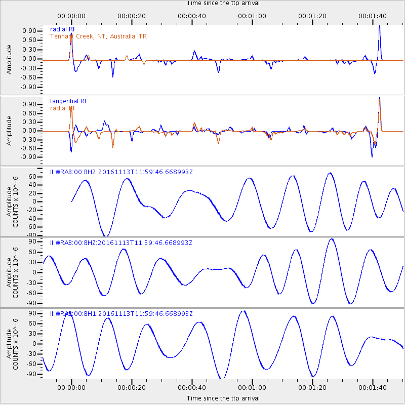
WRAB Tennant Creek, NT, Australia - Earthquake Result Viewer
*The percent match for this event was below the threshold and hence no stack was calculated.
| Earthquake location: |
South Island, New Zealand |
| Earthquake latitude/longitude: |
-42.2/173.6 |
| Earthquake time(UTC): |
2016/11/13 (318) 11:52:45 GMT |
| Earthquake Depth: |
16 km |
| Earthquake Magnitude: |
6.1 MWW |
| Earthquake Catalog/Contributor: |
NEIC PDE/NEIC COMCAT |
|
| Network: |
II Global Seismograph Network (GSN - IRIS/IDA) |
| Station: |
WRAB Tennant Creek, NT, Australia |
| Lat/Lon: |
19.93 S/134.36 E |
| Elevation: |
366 m |
|
| Distance: |
39.8 deg |
| Az: |
291.6 deg |
| Baz: |
132.749 deg |
| Ray Param: |
$rayparam |
*The percent match for this event was below the threshold and hence was not used in the summary stack. |
|
| Radial Match: |
66.31957 % |
| Radial Bump: |
400 |
| Transverse Match: |
33.158012 % |
| Transverse Bump: |
400 |
| SOD ConfigId: |
1858631 |
| Insert Time: |
2016-11-28 15:58:55.811 +0000 |
| GWidth: |
2.5 |
| Max Bumps: |
400 |
| Tol: |
0.001 |
|
Signal To Noise
| Channel | StoN | STA | LTA |
| II:WRAB:00:BHZ:20161113T11:59:46.668993Z | 0.709567 | 2.8959246E-5 | 4.081256E-5 |
| II:WRAB:00:BH1:20161113T11:59:46.668993Z | 1.982666 | 6.677753E-5 | 3.3680673E-5 |
| II:WRAB:00:BH2:20161113T11:59:46.668993Z | 0.7896222 | 3.371431E-5 | 4.2696764E-5 |
| Arrivals |
| Ps | |
| PpPs | |
| PsPs/PpSs | |


