You are here: Home > Network List > PF - Volcanologic Network of Piton de Fournaise-OVPF Stations List
> Station HIM cratere Himiltrude > Earthquake Result Viewer
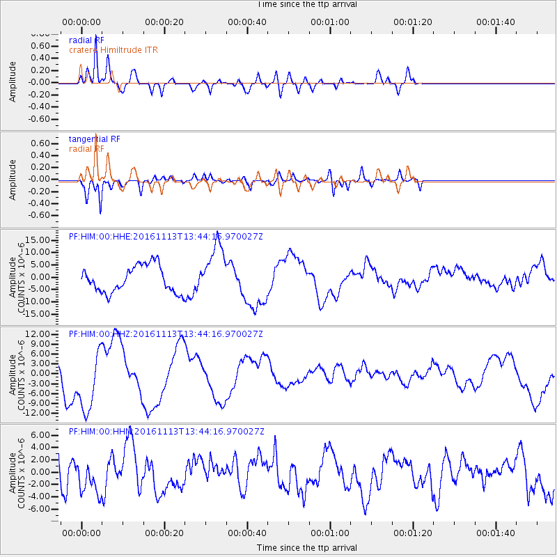
HIM cratere Himiltrude - Earthquake Result Viewer
*The percent match for this event was below the threshold and hence no stack was calculated.
| Earthquake location: |
South Island, New Zealand |
| Earthquake latitude/longitude: |
-42.3/173.7 |
| Earthquake time(UTC): |
2016/11/13 (318) 13:31:26 GMT |
| Earthquake Depth: |
8.3 km |
| Earthquake Magnitude: |
6.2 MWW |
| Earthquake Catalog/Contributor: |
NEIC PDE/NEIC COMCAT |
|
| Network: |
PF Volcanologic Network of Piton de Fournaise-OVPF |
| Station: |
HIM cratere Himiltrude |
| Lat/Lon: |
21.21 S/55.72 E |
| Elevation: |
1958 m |
|
| Distance: |
94.8 deg |
| Az: |
235.787 deg |
| Baz: |
138.884 deg |
| Ray Param: |
$rayparam |
*The percent match for this event was below the threshold and hence was not used in the summary stack. |
|
| Radial Match: |
88.691536 % |
| Radial Bump: |
400 |
| Transverse Match: |
83.173645 % |
| Transverse Bump: |
400 |
| SOD ConfigId: |
1858631 |
| Insert Time: |
2016-11-28 16:00:35.216 +0000 |
| GWidth: |
2.5 |
| Max Bumps: |
400 |
| Tol: |
0.001 |
|
Signal To Noise
| Channel | StoN | STA | LTA |
| PF:HIM:00:HHZ:20161113T13:44:16.970027Z | 1.9648052 | 9.967668E-6 | 5.073108E-6 |
| PF:HIM:00:HHN:20161113T13:44:16.970027Z | 0.91257036 | 2.7541748E-6 | 3.0180408E-6 |
| PF:HIM:00:HHE:20161113T13:44:16.970027Z | 2.045002 | 1.0864588E-5 | 5.312752E-6 |
| Arrivals |
| Ps | |
| PpPs | |
| PsPs/PpSs | |


