You are here: Home > Network List > US - United States National Seismic Network Stations List
> Station HAWA Hanford, Washington, USA > Earthquake Result Viewer
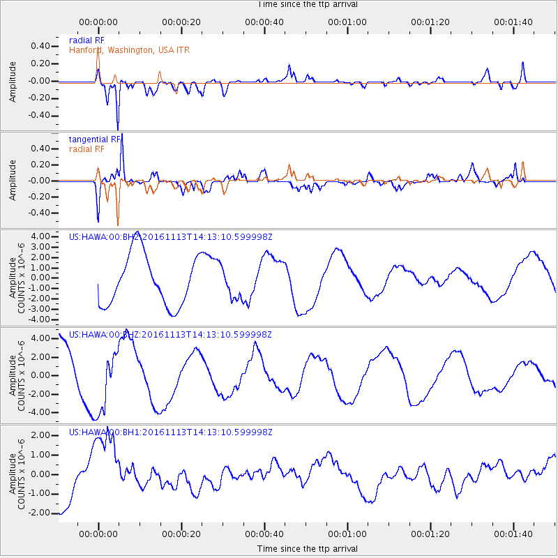
HAWA Hanford, Washington, USA - Earthquake Result Viewer
*The percent match for this event was below the threshold and hence no stack was calculated.
| Earthquake location: |
La Rioja Province, Argentina |
| Earthquake latitude/longitude: |
-28.9/-67.5 |
| Earthquake time(UTC): |
2016/11/13 (318) 14:01:01 GMT |
| Earthquake Depth: |
110 km |
| Earthquake Magnitude: |
6.2 MB, 5.7 MWR |
| Earthquake Catalog/Contributor: |
NEIC PDE/NEIC COMCAT |
|
| Network: |
US United States National Seismic Network |
| Station: |
HAWA Hanford, Washington, USA |
| Lat/Lon: |
46.39 N/119.53 W |
| Elevation: |
364 m |
|
| Distance: |
88.5 deg |
| Az: |
326.901 deg |
| Baz: |
136.212 deg |
| Ray Param: |
$rayparam |
*The percent match for this event was below the threshold and hence was not used in the summary stack. |
|
| Radial Match: |
85.08995 % |
| Radial Bump: |
400 |
| Transverse Match: |
89.22113 % |
| Transverse Bump: |
400 |
| SOD ConfigId: |
1858631 |
| Insert Time: |
2016-11-28 16:04:08.676 +0000 |
| GWidth: |
2.5 |
| Max Bumps: |
400 |
| Tol: |
0.001 |
|
Signal To Noise
| Channel | StoN | STA | LTA |
| US:HAWA:00:BHZ:20161113T14:13:10.599998Z | 1.2480614 | 3.4120071E-6 | 2.7338456E-6 |
| US:HAWA:00:BH1:20161113T14:13:10.599998Z | 2.0286036 | 2.235304E-6 | 1.101893E-6 |
| US:HAWA:00:BH2:20161113T14:13:10.599998Z | 0.6026889 | 1.4860783E-6 | 2.4657468E-6 |
| Arrivals |
| Ps | |
| PpPs | |
| PsPs/PpSs | |


