You are here: Home > Network List > TA - USArray Transportable Network (new EarthScope stations) Stations List
> Station V23A Ortiz Mt. (NFS), Santa Fe National Forest, NM, USA > Earthquake Result Viewer
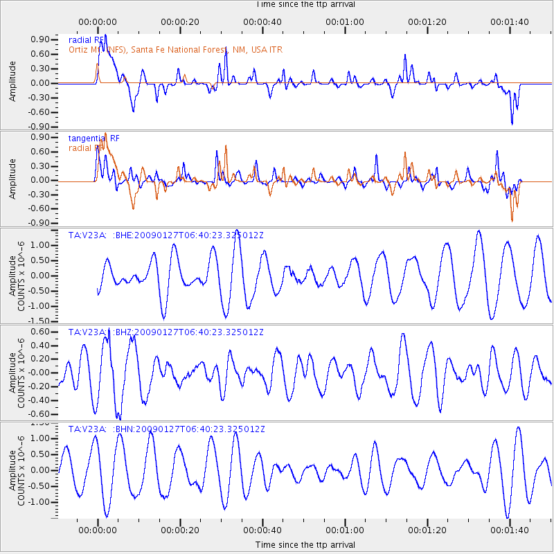
V23A Ortiz Mt. (NFS), Santa Fe National Forest, NM, USA - Earthquake Result Viewer
*The percent match for this event was below the threshold and hence no stack was calculated.
| Earthquake location: |
Fiji Islands Region |
| Earthquake latitude/longitude: |
-17.8/-178.7 |
| Earthquake time(UTC): |
2009/01/27 (027) 06:29:13 GMT |
| Earthquake Depth: |
601 km |
| Earthquake Magnitude: |
5.9 MW, 5.1 MB, 5.8 MW |
| Earthquake Catalog/Contributor: |
WHDF/NEIC |
|
| Network: |
TA USArray Transportable Network (new EarthScope stations) |
| Station: |
V23A Ortiz Mt. (NFS), Santa Fe National Forest, NM, USA |
| Lat/Lon: |
35.75 N/106.18 W |
| Elevation: |
1991 m |
|
| Distance: |
86.8 deg |
| Az: |
50.989 deg |
| Baz: |
245.483 deg |
| Ray Param: |
$rayparam |
*The percent match for this event was below the threshold and hence was not used in the summary stack. |
|
| Radial Match: |
65.60362 % |
| Radial Bump: |
368 |
| Transverse Match: |
45.468716 % |
| Transverse Bump: |
340 |
| SOD ConfigId: |
2658 |
| Insert Time: |
2010-03-06 23:22:01.177 +0000 |
| GWidth: |
2.5 |
| Max Bumps: |
400 |
| Tol: |
0.001 |
|
Signal To Noise
| Channel | StoN | STA | LTA |
| TA:V23A: :BHZ:20090127T06:40:23.325012Z | 1.7968737 | 4.4640004E-7 | 2.4843152E-7 |
| TA:V23A: :BHN:20090127T06:40:23.325012Z | 2.3601017 | 9.194928E-7 | 3.8959877E-7 |
| TA:V23A: :BHE:20090127T06:40:23.325012Z | 2.0950403 | 1.0081043E-6 | 4.8118613E-7 |
| Arrivals |
| Ps | |
| PpPs | |
| PsPs/PpSs | |


