You are here: Home > Network List > II - Global Seismograph Network (GSN - IRIS/IDA) Stations List
> Station WRAB Tennant Creek, NT, Australia > Earthquake Result Viewer
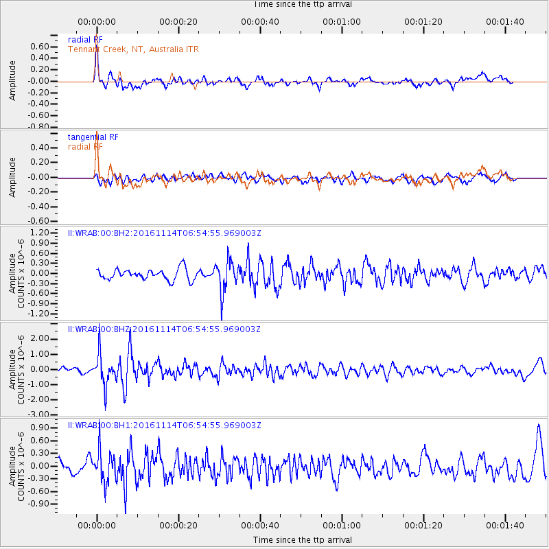
WRAB Tennant Creek, NT, Australia - Earthquake Result Viewer
*The percent match for this event was below the threshold and hence no stack was calculated.
| Earthquake location: |
South Island, New Zealand |
| Earthquake latitude/longitude: |
-42.4/173.9 |
| Earthquake time(UTC): |
2016/11/14 (319) 06:47:52 GMT |
| Earthquake Depth: |
15 km |
| Earthquake Magnitude: |
5.8 MB |
| Earthquake Catalog/Contributor: |
NEIC PDE/NEIC COMCAT |
|
| Network: |
II Global Seismograph Network (GSN - IRIS/IDA) |
| Station: |
WRAB Tennant Creek, NT, Australia |
| Lat/Lon: |
19.93 S/134.36 E |
| Elevation: |
366 m |
|
| Distance: |
40.0 deg |
| Az: |
291.532 deg |
| Baz: |
132.87 deg |
| Ray Param: |
$rayparam |
*The percent match for this event was below the threshold and hence was not used in the summary stack. |
|
| Radial Match: |
79.72048 % |
| Radial Bump: |
400 |
| Transverse Match: |
64.63511 % |
| Transverse Bump: |
400 |
| SOD ConfigId: |
1858631 |
| Insert Time: |
2016-11-28 16:08:14.169 +0000 |
| GWidth: |
2.5 |
| Max Bumps: |
400 |
| Tol: |
0.001 |
|
Signal To Noise
| Channel | StoN | STA | LTA |
| II:WRAB:00:BHZ:20161114T06:54:55.969003Z | 5.267068 | 1.0688343E-6 | 2.0292777E-7 |
| II:WRAB:00:BH1:20161114T06:54:55.969003Z | 2.921844 | 3.7949422E-7 | 1.2988176E-7 |
| II:WRAB:00:BH2:20161114T06:54:55.969003Z | 2.934943 | 4.7423615E-7 | 1.6158275E-7 |
| Arrivals |
| Ps | |
| PpPs | |
| PsPs/PpSs | |


