You are here: Home > Network List > US - United States National Seismic Network Stations List
> Station CBKS Cedar Bluff, Kansas, USA > Earthquake Result Viewer
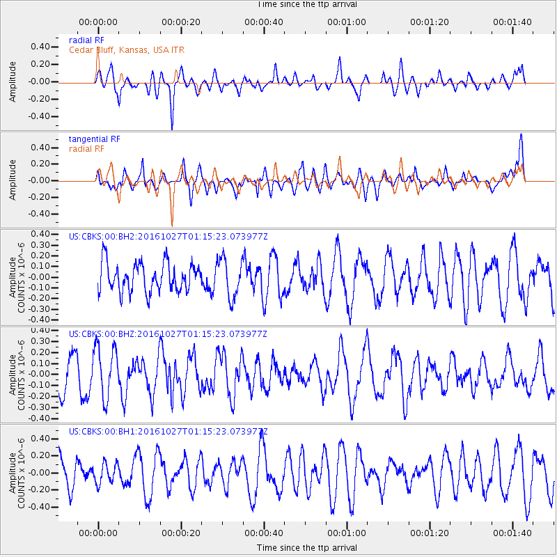
CBKS Cedar Bluff, Kansas, USA - Earthquake Result Viewer
*The percent match for this event was below the threshold and hence no stack was calculated.
| Earthquake location: |
North Of Ascension Island |
| Earthquake latitude/longitude: |
-1.5/-15.6 |
| Earthquake time(UTC): |
2016/10/27 (301) 01:03:12 GMT |
| Earthquake Depth: |
10 km |
| Earthquake Magnitude: |
5.6 MWW, 5.5 MWB |
| Earthquake Catalog/Contributor: |
NEIC PDE/NEIC COMCAT |
|
| Network: |
US United States National Seismic Network |
| Station: |
CBKS Cedar Bluff, Kansas, USA |
| Lat/Lon: |
38.81 N/99.74 W |
| Elevation: |
677 m |
|
| Distance: |
86.4 deg |
| Az: |
308.856 deg |
| Baz: |
94.83 deg |
| Ray Param: |
$rayparam |
*The percent match for this event was below the threshold and hence was not used in the summary stack. |
|
| Radial Match: |
61.40251 % |
| Radial Bump: |
400 |
| Transverse Match: |
46.898422 % |
| Transverse Bump: |
400 |
| SOD ConfigId: |
1858631 |
| Insert Time: |
2016-11-29 05:33:46.507 +0000 |
| GWidth: |
2.5 |
| Max Bumps: |
400 |
| Tol: |
0.001 |
|
Signal To Noise
| Channel | StoN | STA | LTA |
| US:CBKS:00:BHZ:20161027T01:15:23.073977Z | 1.4952292 | 2.3439578E-7 | 1.5676244E-7 |
| US:CBKS:00:BH1:20161027T01:15:23.073977Z | 0.62599194 | 1.18365165E-7 | 1.8908416E-7 |
| US:CBKS:00:BH2:20161027T01:15:23.073977Z | 1.372953 | 1.8400499E-7 | 1.3402133E-7 |
| Arrivals |
| Ps | |
| PpPs | |
| PsPs/PpSs | |


