You are here: Home > Network List > TA - USArray Transportable Network (new EarthScope stations) Stations List
> Station 527A Woodward Ranch, Alpine, TX, USA > Earthquake Result Viewer
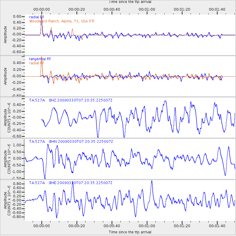
527A Woodward Ranch, Alpine, TX, USA - Earthquake Result Viewer
*The percent match for this event was below the threshold and hence no stack was calculated.
| Earthquake location: |
Kodiak Island Region, Alaska |
| Earthquake latitude/longitude: |
56.5/-152.7 |
| Earthquake time(UTC): |
2009/03/30 (089) 07:13:07 GMT |
| Earthquake Depth: |
21 km |
| Earthquake Magnitude: |
5.9 MB, 5.9 MS, 5.9 MW, 5.9 MW |
| Earthquake Catalog/Contributor: |
WHDF/NEIC |
|
| Network: |
TA USArray Transportable Network (new EarthScope stations) |
| Station: |
527A Woodward Ranch, Alpine, TX, USA |
| Lat/Lon: |
30.15 N/103.61 W |
| Elevation: |
1419 m |
|
| Distance: |
43.1 deg |
| Az: |
106.592 deg |
| Baz: |
322.21 deg |
| Ray Param: |
$rayparam |
*The percent match for this event was below the threshold and hence was not used in the summary stack. |
|
| Radial Match: |
77.24244 % |
| Radial Bump: |
351 |
| Transverse Match: |
55.481197 % |
| Transverse Bump: |
334 |
| SOD ConfigId: |
2658 |
| Insert Time: |
2010-03-06 23:27:18.914 +0000 |
| GWidth: |
2.5 |
| Max Bumps: |
400 |
| Tol: |
0.001 |
|
Signal To Noise
| Channel | StoN | STA | LTA |
| TA:527A: :BHN:20090330T07:20:35.225007Z | 6.9057226 | 7.7214247E-7 | 1.1181197E-7 |
| TA:527A: :BHE:20090330T07:20:35.225007Z | 2.9357862 | 3.127475E-7 | 1.0652938E-7 |
| TA:527A: :BHZ:20090330T07:20:35.225007Z | 1.7568922 | 2.8776262E-7 | 1.637907E-7 |
| Arrivals |
| Ps | |
| PpPs | |
| PsPs/PpSs | |


