You are here: Home > Network List > US - United States National Seismic Network Stations List
> Station HAWA Hanford, Washington, USA > Earthquake Result Viewer
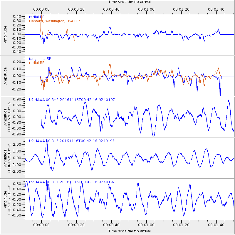
HAWA Hanford, Washington, USA - Earthquake Result Viewer
*The percent match for this event was below the threshold and hence no stack was calculated.
| Earthquake location: |
Tonga Islands Region |
| Earthquake latitude/longitude: |
-20.2/-173.0 |
| Earthquake time(UTC): |
2016/11/16 (321) 00:30:28 GMT |
| Earthquake Depth: |
10 km |
| Earthquake Magnitude: |
5.9 MB, 5.6 MWB |
| Earthquake Catalog/Contributor: |
NEIC PDE/NEIC COMCAT |
|
| Network: |
US United States National Seismic Network |
| Station: |
HAWA Hanford, Washington, USA |
| Lat/Lon: |
46.39 N/119.53 W |
| Elevation: |
364 m |
|
| Distance: |
82.0 deg |
| Az: |
34.151 deg |
| Baz: |
229.624 deg |
| Ray Param: |
$rayparam |
*The percent match for this event was below the threshold and hence was not used in the summary stack. |
|
| Radial Match: |
53.234177 % |
| Radial Bump: |
400 |
| Transverse Match: |
70.86266 % |
| Transverse Bump: |
400 |
| SOD ConfigId: |
1858631 |
| Insert Time: |
2016-11-30 00:34:29.346 +0000 |
| GWidth: |
2.5 |
| Max Bumps: |
400 |
| Tol: |
0.001 |
|
Signal To Noise
| Channel | StoN | STA | LTA |
| US:HAWA:00:BHZ:20161116T00:42:16.924019Z | 3.735549 | 1.1597208E-6 | 3.1045522E-7 |
| US:HAWA:00:BH1:20161116T00:42:16.924019Z | 1.169132 | 4.6052446E-7 | 3.9390287E-7 |
| US:HAWA:00:BH2:20161116T00:42:16.924019Z | 1.1657152 | 3.3985572E-7 | 2.9154265E-7 |
| Arrivals |
| Ps | |
| PpPs | |
| PsPs/PpSs | |


