You are here: Home > Network List > TA - USArray Transportable Network (new EarthScope stations) Stations List
> Station B18K Kokolik River, AK, USA > Earthquake Result Viewer
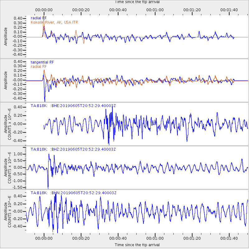
B18K Kokolik River, AK, USA - Earthquake Result Viewer
*The percent match for this event was below the threshold and hence no stack was calculated.
| Earthquake location: |
Mindanao, Philippines |
| Earthquake latitude/longitude: |
6.5/124.2 |
| Earthquake time(UTC): |
2019/06/05 (156) 20:41:49 GMT |
| Earthquake Depth: |
466 km |
| Earthquake Magnitude: |
5.5 Mww |
| Earthquake Catalog/Contributor: |
NEIC PDE/us |
|
| Network: |
TA USArray Transportable Network (new EarthScope stations) |
| Station: |
B18K Kokolik River, AK, USA |
| Lat/Lon: |
69.36 N/161.80 W |
| Elevation: |
222 m |
|
| Distance: |
78.4 deg |
| Az: |
20.364 deg |
| Baz: |
257.27 deg |
| Ray Param: |
$rayparam |
*The percent match for this event was below the threshold and hence was not used in the summary stack. |
|
| Radial Match: |
62.076523 % |
| Radial Bump: |
400 |
| Transverse Match: |
59.44079 % |
| Transverse Bump: |
400 |
| SOD ConfigId: |
18369291 |
| Insert Time: |
2019-06-19 20:44:44.556 +0000 |
| GWidth: |
2.5 |
| Max Bumps: |
400 |
| Tol: |
0.001 |
|
Signal To Noise
| Channel | StoN | STA | LTA |
| TA:B18K: :BHZ:20190605T20:52:29.40003Z | 2.2919896 | 5.0095656E-7 | 2.1856845E-7 |
| TA:B18K: :BHN:20190605T20:52:29.40003Z | 1.1093869 | 1.787442E-7 | 1.611198E-7 |
| TA:B18K: :BHE:20190605T20:52:29.40003Z | 1.3958962 | 1.5943168E-7 | 1.1421457E-7 |
| Arrivals |
| Ps | |
| PpPs | |
| PsPs/PpSs | |


