You are here: Home > Network List > TA - USArray Transportable Network (new EarthScope stations) Stations List
> Station 126A Clayton Basin, Artesia, NM, USA > Earthquake Result Viewer
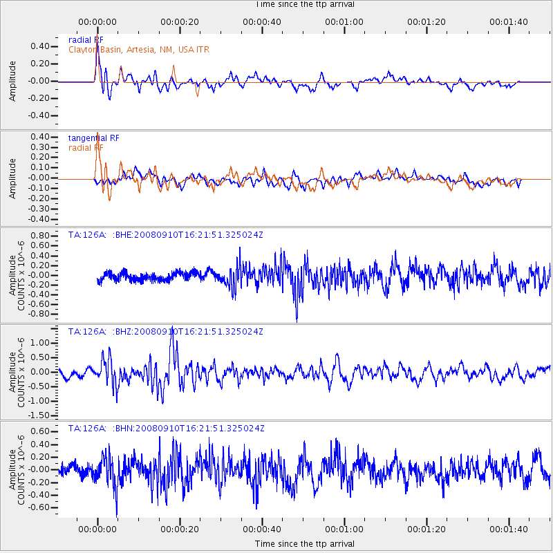
126A Clayton Basin, Artesia, NM, USA - Earthquake Result Viewer
*The percent match for this event was below the threshold and hence no stack was calculated.
| Earthquake location: |
Northern Chile |
| Earthquake latitude/longitude: |
-20.3/-69.2 |
| Earthquake time(UTC): |
2008/09/10 (254) 16:12:04 GMT |
| Earthquake Depth: |
38 km |
| Earthquake Magnitude: |
5.6 MB, 5.3 MS |
| Earthquake Catalog/Contributor: |
WHDF/NEIC |
|
| Network: |
TA USArray Transportable Network (new EarthScope stations) |
| Station: |
126A Clayton Basin, Artesia, NM, USA |
| Lat/Lon: |
32.65 N/104.02 W |
| Elevation: |
1032 m |
|
| Distance: |
62.2 deg |
| Az: |
327.043 deg |
| Baz: |
142.742 deg |
| Ray Param: |
$rayparam |
*The percent match for this event was below the threshold and hence was not used in the summary stack. |
|
| Radial Match: |
75.514626 % |
| Radial Bump: |
400 |
| Transverse Match: |
68.09993 % |
| Transverse Bump: |
400 |
| SOD ConfigId: |
2560 |
| Insert Time: |
2010-03-06 23:29:33.206 +0000 |
| GWidth: |
2.5 |
| Max Bumps: |
400 |
| Tol: |
0.001 |
|
Signal To Noise
| Channel | StoN | STA | LTA |
| TA:126A: :BHZ:20080910T16:21:51.325024Z | 3.6919343 | 4.4436194E-7 | 1.203602E-7 |
| TA:126A: :BHN:20080910T16:21:51.325024Z | 2.0150895 | 2.3428105E-7 | 1.1626335E-7 |
| TA:126A: :BHE:20080910T16:21:51.325024Z | 2.6089547 | 2.0602734E-7 | 7.89693E-8 |
| Arrivals |
| Ps | |
| PpPs | |
| PsPs/PpSs | |


