You are here: Home > Network List > TA - USArray Transportable Network (new EarthScope stations) Stations List
> Station 126A Clayton Basin, Artesia, NM, USA > Earthquake Result Viewer
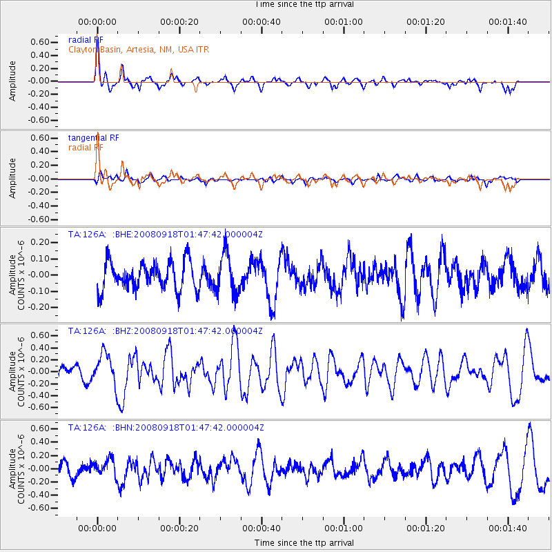
126A Clayton Basin, Artesia, NM, USA - Earthquake Result Viewer
*The percent match for this event was below the threshold and hence no stack was calculated.
| Earthquake location: |
Central East Pacific Rise |
| Earthquake latitude/longitude: |
-4.6/-106.0 |
| Earthquake time(UTC): |
2008/09/18 (262) 01:41:02 GMT |
| Earthquake Depth: |
10 km |
| Earthquake Magnitude: |
5.5 MB, 5.7 MS, 6.0 MW, 6.0 MW |
| Earthquake Catalog/Contributor: |
WHDF/NEIC |
|
| Network: |
TA USArray Transportable Network (new EarthScope stations) |
| Station: |
126A Clayton Basin, Artesia, NM, USA |
| Lat/Lon: |
32.65 N/104.02 W |
| Elevation: |
1032 m |
|
| Distance: |
37.0 deg |
| Az: |
2.773 deg |
| Baz: |
183.277 deg |
| Ray Param: |
$rayparam |
*The percent match for this event was below the threshold and hence was not used in the summary stack. |
|
| Radial Match: |
79.031494 % |
| Radial Bump: |
400 |
| Transverse Match: |
49.943836 % |
| Transverse Bump: |
400 |
| SOD ConfigId: |
2560 |
| Insert Time: |
2010-03-06 23:29:34.692 +0000 |
| GWidth: |
2.5 |
| Max Bumps: |
400 |
| Tol: |
0.001 |
|
Signal To Noise
| Channel | StoN | STA | LTA |
| TA:126A: :BHZ:20080918T01:47:42.000004Z | 2.1709187 | 2.690871E-7 | 1.239508E-7 |
| TA:126A: :BHN:20080918T01:47:42.000004Z | 1.5572186 | 1.3239057E-7 | 8.5017334E-8 |
| TA:126A: :BHE:20080918T01:47:42.000004Z | 1.4545555 | 1.2518748E-7 | 8.60658E-8 |
| Arrivals |
| Ps | |
| PpPs | |
| PsPs/PpSs | |


