You are here: Home > Network List > TA - USArray Transportable Network (new EarthScope stations) Stations List
> Station 126A Clayton Basin, Artesia, NM, USA > Earthquake Result Viewer
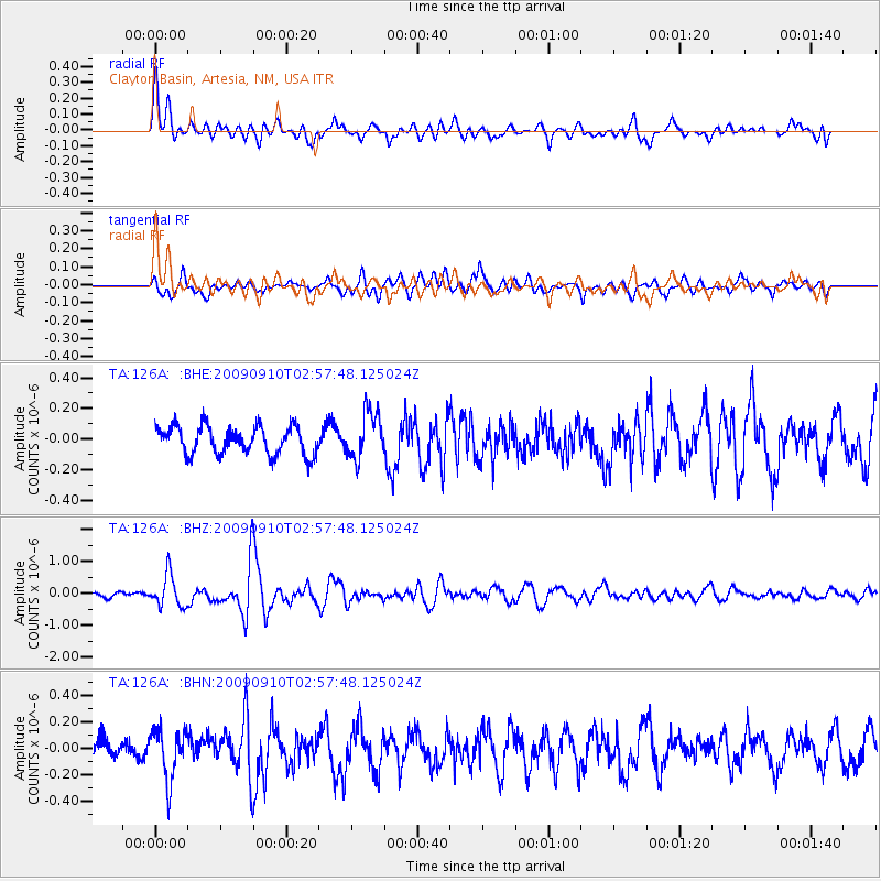
126A Clayton Basin, Artesia, NM, USA - Earthquake Result Viewer
*The percent match for this event was below the threshold and hence no stack was calculated.
| Earthquake location: |
Kuril Islands |
| Earthquake latitude/longitude: |
48.3/154.2 |
| Earthquake time(UTC): |
2009/09/10 (253) 02:46:50 GMT |
| Earthquake Depth: |
36 km |
| Earthquake Magnitude: |
6.0 MB, 5.5 MS, 6.0 MW, 5.8 MW |
| Earthquake Catalog/Contributor: |
WHDF/NEIC |
|
| Network: |
TA USArray Transportable Network (new EarthScope stations) |
| Station: |
126A Clayton Basin, Artesia, NM, USA |
| Lat/Lon: |
32.65 N/104.02 W |
| Elevation: |
1032 m |
|
| Distance: |
73.5 deg |
| Az: |
59.488 deg |
| Baz: |
317.028 deg |
| Ray Param: |
$rayparam |
*The percent match for this event was below the threshold and hence was not used in the summary stack. |
|
| Radial Match: |
74.90994 % |
| Radial Bump: |
400 |
| Transverse Match: |
72.233574 % |
| Transverse Bump: |
400 |
| SOD ConfigId: |
2622 |
| Insert Time: |
2010-03-06 23:29:48.614 +0000 |
| GWidth: |
2.5 |
| Max Bumps: |
400 |
| Tol: |
0.001 |
|
Signal To Noise
| Channel | StoN | STA | LTA |
| TA:126A: :BHZ:20090910T02:57:48.125024Z | 4.304467 | 4.9882806E-7 | 1.1588613E-7 |
| TA:126A: :BHN:20090910T02:57:48.125024Z | 2.4469147 | 1.9029659E-7 | 7.777001E-8 |
| TA:126A: :BHE:20090910T02:57:48.125024Z | 1.7294294 | 1.559571E-7 | 9.017836E-8 |
| Arrivals |
| Ps | |
| PpPs | |
| PsPs/PpSs | |


