You are here: Home > Network List > TA - USArray Transportable Network (new EarthScope stations) Stations List
> Station 126A Clayton Basin, Artesia, NM, USA > Earthquake Result Viewer
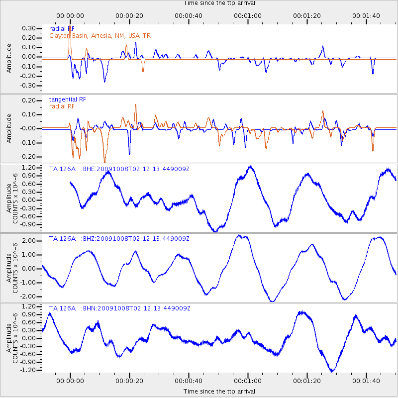
126A Clayton Basin, Artesia, NM, USA - Earthquake Result Viewer
*The percent match for this event was below the threshold and hence no stack was calculated.
| Earthquake location: |
Santa Cruz Islands |
| Earthquake latitude/longitude: |
-11.9/166.0 |
| Earthquake time(UTC): |
2009/10/08 (281) 01:59:19 GMT |
| Earthquake Depth: |
35 km |
| Earthquake Magnitude: |
5.9 MB |
| Earthquake Catalog/Contributor: |
WHDF/NEIC |
|
| Network: |
TA USArray Transportable Network (new EarthScope stations) |
| Station: |
126A Clayton Basin, Artesia, NM, USA |
| Lat/Lon: |
32.65 N/104.02 W |
| Elevation: |
1032 m |
|
| Distance: |
96.3 deg |
| Az: |
58.085 deg |
| Baz: |
259.997 deg |
| Ray Param: |
$rayparam |
*The percent match for this event was below the threshold and hence was not used in the summary stack. |
|
| Radial Match: |
61.299595 % |
| Radial Bump: |
400 |
| Transverse Match: |
73.96586 % |
| Transverse Bump: |
400 |
| SOD ConfigId: |
2622 |
| Insert Time: |
2010-03-06 23:29:55.850 +0000 |
| GWidth: |
2.5 |
| Max Bumps: |
400 |
| Tol: |
0.001 |
|
Signal To Noise
| Channel | StoN | STA | LTA |
| TA:126A: :BHZ:20091008T02:12:13.449009Z | 1.4234076 | 8.994417E-7 | 6.3189333E-7 |
| TA:126A: :BHN:20091008T02:12:13.449009Z | 1.0847983 | 4.8341366E-7 | 4.4562537E-7 |
| TA:126A: :BHE:20091008T02:12:13.449009Z | 1.1977142 | 4.5913188E-7 | 3.833401E-7 |
| Arrivals |
| Ps | |
| PpPs | |
| PsPs/PpSs | |


