You are here: Home > Network List > CI - Caltech Regional Seismic Network Stations List
> Station MPM Manuel Prospect Mine, California, USA > Earthquake Result Viewer
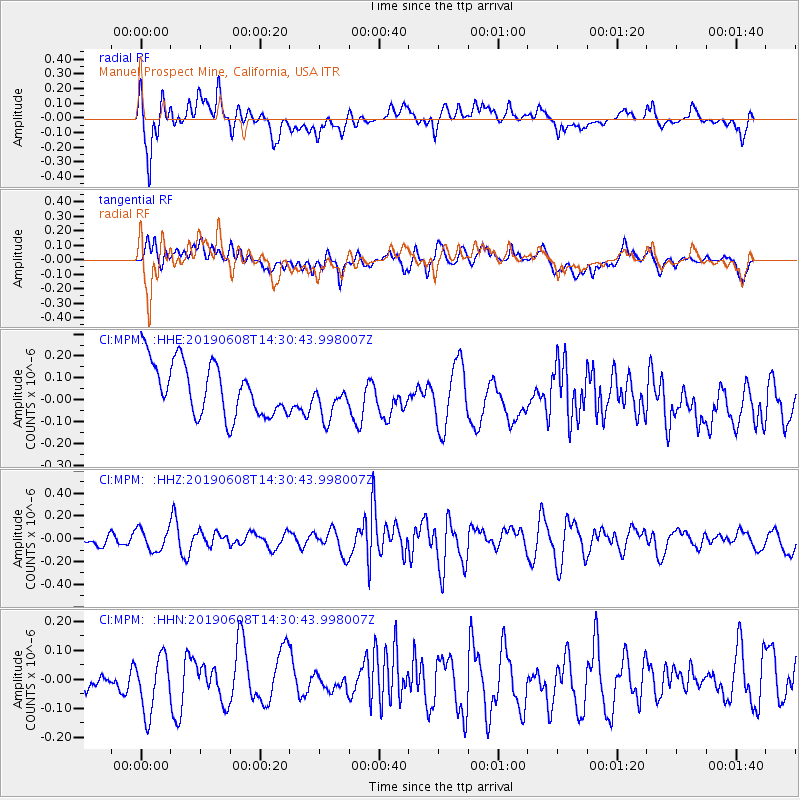
MPM Manuel Prospect Mine, California, USA - Earthquake Result Viewer
*The percent match for this event was below the threshold and hence no stack was calculated.
| Earthquake location: |
South Of Fiji Islands |
| Earthquake latitude/longitude: |
-25.2/-177.0 |
| Earthquake time(UTC): |
2019/06/08 (159) 14:19:03 GMT |
| Earthquake Depth: |
113 km |
| Earthquake Magnitude: |
5.3 Mww |
| Earthquake Catalog/Contributor: |
NEIC PDE/us |
|
| Network: |
CI Caltech Regional Seismic Network |
| Station: |
MPM Manuel Prospect Mine, California, USA |
| Lat/Lon: |
36.06 N/117.49 W |
| Elevation: |
185 m |
|
| Distance: |
82.9 deg |
| Az: |
44.728 deg |
| Baz: |
231.885 deg |
| Ray Param: |
$rayparam |
*The percent match for this event was below the threshold and hence was not used in the summary stack. |
|
| Radial Match: |
56.78594 % |
| Radial Bump: |
400 |
| Transverse Match: |
61.565983 % |
| Transverse Bump: |
400 |
| SOD ConfigId: |
18369291 |
| Insert Time: |
2019-06-22 14:20:57.227 +0000 |
| GWidth: |
2.5 |
| Max Bumps: |
400 |
| Tol: |
0.001 |
|
Signal To Noise
| Channel | StoN | STA | LTA |
| CI:MPM: :HHZ:20190608T14:30:43.998007Z | 0.6731081 | 9.5834764E-8 | 1.4237648E-7 |
| CI:MPM: :HHN:20190608T14:30:43.998007Z | 1.2450403 | 9.842569E-8 | 7.905422E-8 |
| CI:MPM: :HHE:20190608T14:30:43.998007Z | 0.75352013 | 9.1079855E-8 | 1.2087249E-7 |
| Arrivals |
| Ps | |
| PpPs | |
| PsPs/PpSs | |


