You are here: Home > Network List > TA - USArray Transportable Network (new EarthScope stations) Stations List
> Station 126A Clayton Basin, Artesia, NM, USA > Earthquake Result Viewer
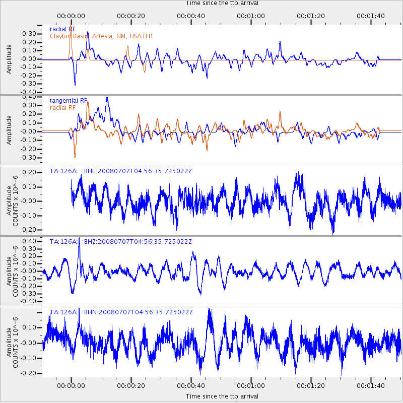
126A Clayton Basin, Artesia, NM, USA - Earthquake Result Viewer
*The percent match for this event was below the threshold and hence no stack was calculated.
| Earthquake location: |
Tonga Islands |
| Earthquake latitude/longitude: |
-16.4/-174.0 |
| Earthquake time(UTC): |
2008/07/07 (189) 04:44:55 GMT |
| Earthquake Depth: |
116 km |
| Earthquake Magnitude: |
5.5 MW, 5.0 MB, 5.5 MW |
| Earthquake Catalog/Contributor: |
WHDF/NEIC |
|
| Network: |
TA USArray Transportable Network (new EarthScope stations) |
| Station: |
126A Clayton Basin, Artesia, NM, USA |
| Lat/Lon: |
32.65 N/104.02 W |
| Elevation: |
1032 m |
|
| Distance: |
82.8 deg |
| Az: |
53.058 deg |
| Baz: |
245.391 deg |
| Ray Param: |
$rayparam |
*The percent match for this event was below the threshold and hence was not used in the summary stack. |
|
| Radial Match: |
54.956985 % |
| Radial Bump: |
400 |
| Transverse Match: |
43.404373 % |
| Transverse Bump: |
400 |
| SOD ConfigId: |
2504 |
| Insert Time: |
2010-03-06 23:30:51.572 +0000 |
| GWidth: |
2.5 |
| Max Bumps: |
400 |
| Tol: |
0.001 |
|
Signal To Noise
| Channel | StoN | STA | LTA |
| TA:126A: :BHZ:20080707T04:56:35.725022Z | 2.2362297 | 1.7931815E-7 | 8.018771E-8 |
| TA:126A: :BHN:20080707T04:56:35.725022Z | 1.05446 | 8.5397204E-8 | 8.0986666E-8 |
| TA:126A: :BHE:20080707T04:56:35.725022Z | 0.9339491 | 6.189589E-8 | 6.62733E-8 |
| Arrivals |
| Ps | |
| PpPs | |
| PsPs/PpSs | |


