You are here: Home > Network List > CI - Caltech Regional Seismic Network Stations List
> Station MPM Manuel Prospect Mine, California, USA > Earthquake Result Viewer
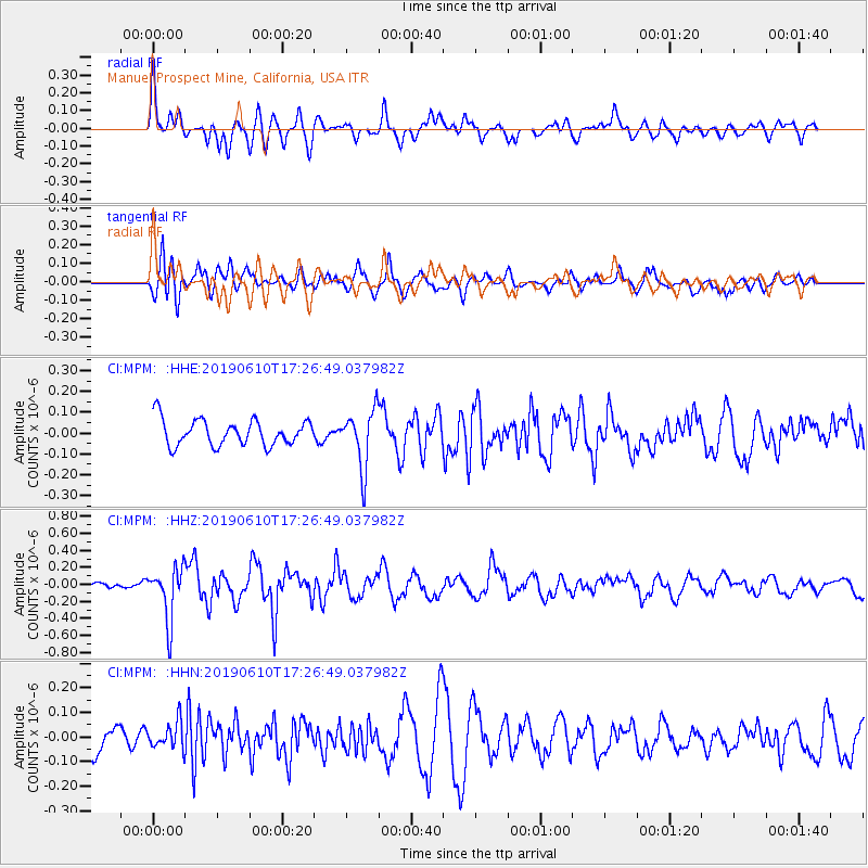
MPM Manuel Prospect Mine, California, USA - Earthquake Result Viewer
*The percent match for this event was below the threshold and hence no stack was calculated.
| Earthquake location: |
Mariana Islands Region |
| Earthquake latitude/longitude: |
17.4/147.8 |
| Earthquake time(UTC): |
2019/06/10 (161) 17:14:53 GMT |
| Earthquake Depth: |
22 km |
| Earthquake Magnitude: |
5.4 Mww |
| Earthquake Catalog/Contributor: |
NEIC PDE/us |
|
| Network: |
CI Caltech Regional Seismic Network |
| Station: |
MPM Manuel Prospect Mine, California, USA |
| Lat/Lon: |
36.06 N/117.49 W |
| Elevation: |
185 m |
|
| Distance: |
83.7 deg |
| Az: |
54.338 deg |
| Baz: |
286.791 deg |
| Ray Param: |
$rayparam |
*The percent match for this event was below the threshold and hence was not used in the summary stack. |
|
| Radial Match: |
68.05999 % |
| Radial Bump: |
400 |
| Transverse Match: |
62.09592 % |
| Transverse Bump: |
400 |
| SOD ConfigId: |
18369291 |
| Insert Time: |
2019-06-24 17:17:18.968 +0000 |
| GWidth: |
2.5 |
| Max Bumps: |
400 |
| Tol: |
0.001 |
|
Signal To Noise
| Channel | StoN | STA | LTA |
| CI:MPM: :HHZ:20190610T17:26:49.037982Z | 2.1372676 | 3.0975355E-7 | 1.449297E-7 |
| CI:MPM: :HHN:20190610T17:26:49.037982Z | 0.7027051 | 5.4911755E-8 | 7.814339E-8 |
| CI:MPM: :HHE:20190610T17:26:49.037982Z | 2.2695282 | 1.3968172E-7 | 6.154659E-8 |
| Arrivals |
| Ps | |
| PpPs | |
| PsPs/PpSs | |


