You are here: Home > Network List > II - Global Seismograph Network (GSN - IRIS/IDA) Stations List
> Station WRAB Tennant Creek, NT, Australia > Earthquake Result Viewer
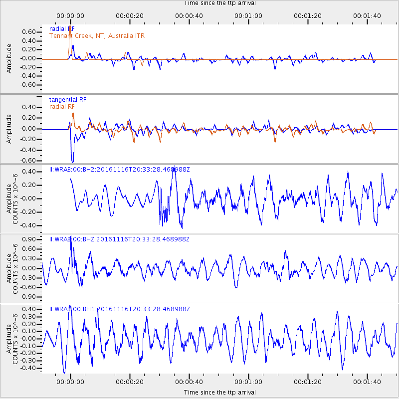
WRAB Tennant Creek, NT, Australia - Earthquake Result Viewer
*The percent match for this event was below the threshold and hence no stack was calculated.
| Earthquake location: |
South Of Fiji Islands |
| Earthquake latitude/longitude: |
-22.1/-177.6 |
| Earthquake time(UTC): |
2016/11/16 (321) 20:26:15 GMT |
| Earthquake Depth: |
305 km |
| Earthquake Magnitude: |
5.5 MB |
| Earthquake Catalog/Contributor: |
NEIC PDE/NEIC COMCAT |
|
| Network: |
II Global Seismograph Network (GSN - IRIS/IDA) |
| Station: |
WRAB Tennant Creek, NT, Australia |
| Lat/Lon: |
19.93 S/134.36 E |
| Elevation: |
366 m |
|
| Distance: |
44.7 deg |
| Az: |
263.593 deg |
| Baz: |
101.657 deg |
| Ray Param: |
$rayparam |
*The percent match for this event was below the threshold and hence was not used in the summary stack. |
|
| Radial Match: |
74.295364 % |
| Radial Bump: |
400 |
| Transverse Match: |
70.56883 % |
| Transverse Bump: |
400 |
| SOD ConfigId: |
1858631 |
| Insert Time: |
2016-11-30 20:29:04.070 +0000 |
| GWidth: |
2.5 |
| Max Bumps: |
400 |
| Tol: |
0.001 |
|
Signal To Noise
| Channel | StoN | STA | LTA |
| II:WRAB:00:BHZ:20161116T20:33:28.468988Z | 1.6749737 | 3.9135585E-7 | 2.3364895E-7 |
| II:WRAB:00:BH1:20161116T20:33:28.468988Z | 1.605372 | 2.4969364E-7 | 1.5553631E-7 |
| II:WRAB:00:BH2:20161116T20:33:28.468988Z | 2.1214876 | 2.465957E-7 | 1.16237175E-7 |
| Arrivals |
| Ps | |
| PpPs | |
| PsPs/PpSs | |


