You are here: Home > Network List > IU - Global Seismograph Network (GSN - IRIS/USGS) Stations List
> Station CTAO Charters Towers, Australia > Earthquake Result Viewer
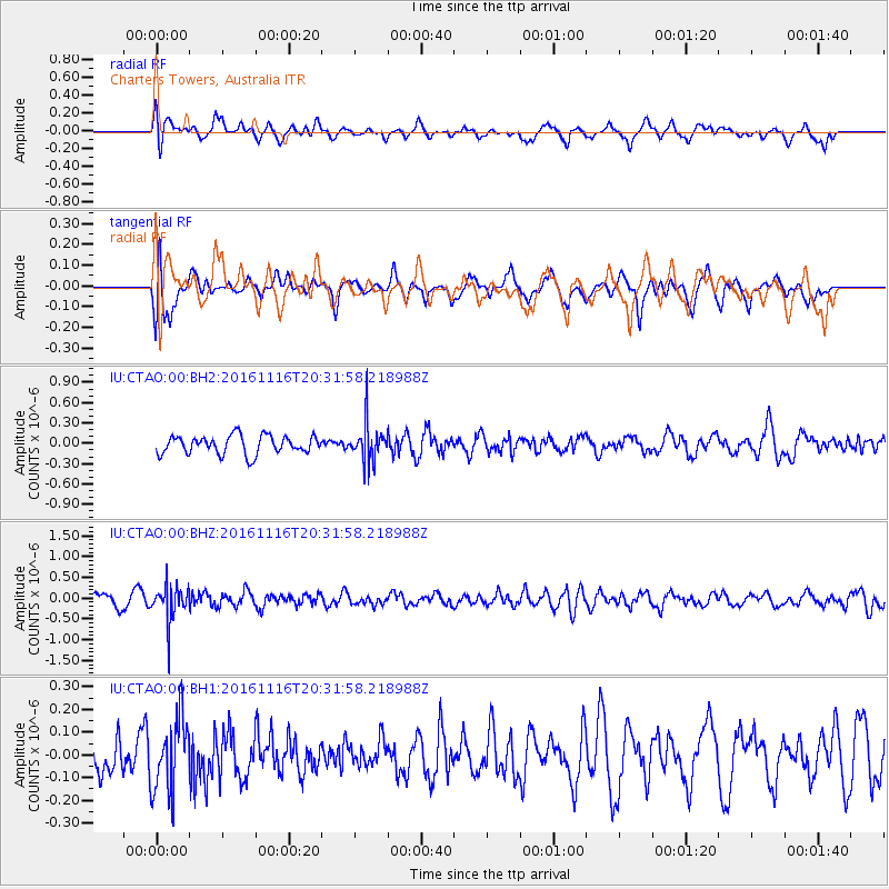
CTAO Charters Towers, Australia - Earthquake Result Viewer
*The percent match for this event was below the threshold and hence no stack was calculated.
| Earthquake location: |
South Of Fiji Islands |
| Earthquake latitude/longitude: |
-22.1/-177.6 |
| Earthquake time(UTC): |
2016/11/16 (321) 20:26:15 GMT |
| Earthquake Depth: |
305 km |
| Earthquake Magnitude: |
5.5 MB |
| Earthquake Catalog/Contributor: |
NEIC PDE/NEIC COMCAT |
|
| Network: |
IU Global Seismograph Network (GSN - IRIS/USGS) |
| Station: |
CTAO Charters Towers, Australia |
| Lat/Lon: |
20.09 S/146.25 E |
| Elevation: |
357 m |
|
| Distance: |
33.7 deg |
| Az: |
266.672 deg |
| Baz: |
99.994 deg |
| Ray Param: |
$rayparam |
*The percent match for this event was below the threshold and hence was not used in the summary stack. |
|
| Radial Match: |
68.82962 % |
| Radial Bump: |
400 |
| Transverse Match: |
53.756805 % |
| Transverse Bump: |
400 |
| SOD ConfigId: |
1858631 |
| Insert Time: |
2016-11-30 20:29:22.742 +0000 |
| GWidth: |
2.5 |
| Max Bumps: |
400 |
| Tol: |
0.001 |
|
Signal To Noise
| Channel | StoN | STA | LTA |
| IU:CTAO:00:BHZ:20161116T20:31:58.218988Z | 3.586591 | 4.1476895E-7 | 1.1564434E-7 |
| IU:CTAO:00:BH1:20161116T20:31:58.218988Z | 1.4527768 | 1.6300311E-7 | 1.12201064E-7 |
| IU:CTAO:00:BH2:20161116T20:31:58.218988Z | 2.052041 | 2.7721163E-7 | 1.3509067E-7 |
| Arrivals |
| Ps | |
| PpPs | |
| PsPs/PpSs | |


