You are here: Home > Network List > TA - USArray Transportable Network (new EarthScope stations) Stations List
> Station B18K Kokolik River, AK, USA > Earthquake Result Viewer
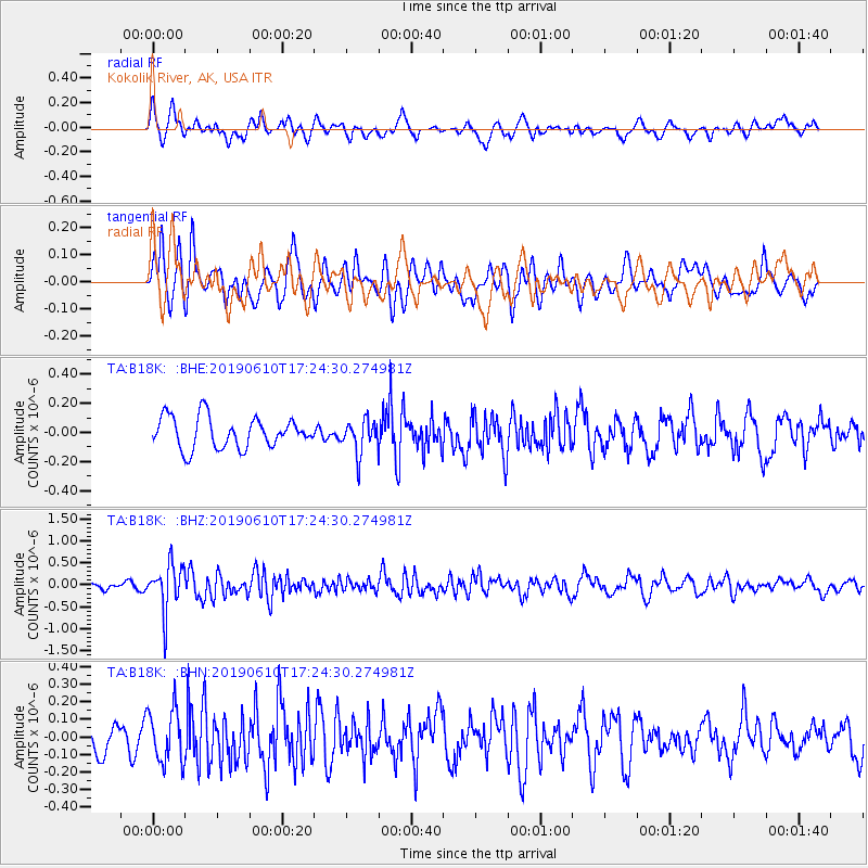
B18K Kokolik River, AK, USA - Earthquake Result Viewer
*The percent match for this event was below the threshold and hence no stack was calculated.
| Earthquake location: |
Mariana Islands Region |
| Earthquake latitude/longitude: |
17.4/147.8 |
| Earthquake time(UTC): |
2019/06/10 (161) 17:14:53 GMT |
| Earthquake Depth: |
22 km |
| Earthquake Magnitude: |
5.4 Mww |
| Earthquake Catalog/Contributor: |
NEIC PDE/us |
|
| Network: |
TA USArray Transportable Network (new EarthScope stations) |
| Station: |
B18K Kokolik River, AK, USA |
| Lat/Lon: |
69.36 N/161.80 W |
| Elevation: |
222 m |
|
| Distance: |
60.4 deg |
| Az: |
18.313 deg |
| Baz: |
237.808 deg |
| Ray Param: |
$rayparam |
*The percent match for this event was below the threshold and hence was not used in the summary stack. |
|
| Radial Match: |
56.31489 % |
| Radial Bump: |
400 |
| Transverse Match: |
69.5734 % |
| Transverse Bump: |
400 |
| SOD ConfigId: |
18369291 |
| Insert Time: |
2019-06-24 17:20:17.659 +0000 |
| GWidth: |
2.5 |
| Max Bumps: |
400 |
| Tol: |
0.001 |
|
Signal To Noise
| Channel | StoN | STA | LTA |
| TA:B18K: :BHZ:20190610T17:24:30.274981Z | 5.410861 | 5.252008E-7 | 9.706418E-8 |
| TA:B18K: :BHN:20190610T17:24:30.274981Z | 2.0177755 | 1.5092134E-7 | 7.47959E-8 |
| TA:B18K: :BHE:20190610T17:24:30.274981Z | 1.0553943 | 1.121379E-7 | 1.06252145E-7 |
| Arrivals |
| Ps | |
| PpPs | |
| PsPs/PpSs | |


