You are here: Home > Network List > TA - USArray Transportable Network (new EarthScope stations) Stations List
> Station E20K Nigu River, AK, USA > Earthquake Result Viewer
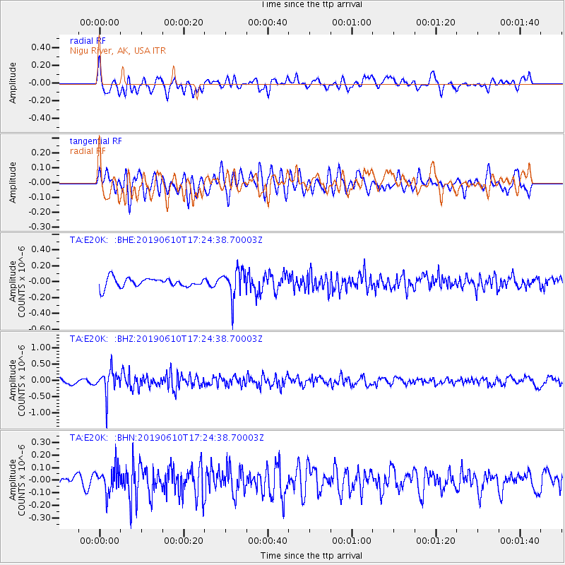
E20K Nigu River, AK, USA - Earthquake Result Viewer
*The percent match for this event was below the threshold and hence no stack was calculated.
| Earthquake location: |
Mariana Islands Region |
| Earthquake latitude/longitude: |
17.4/147.8 |
| Earthquake time(UTC): |
2019/06/10 (161) 17:14:53 GMT |
| Earthquake Depth: |
22 km |
| Earthquake Magnitude: |
5.4 Mww |
| Earthquake Catalog/Contributor: |
NEIC PDE/us |
|
| Network: |
TA USArray Transportable Network (new EarthScope stations) |
| Station: |
E20K Nigu River, AK, USA |
| Lat/Lon: |
68.26 N/156.19 W |
| Elevation: |
866 m |
|
| Distance: |
61.7 deg |
| Az: |
20.554 deg |
| Baz: |
244.123 deg |
| Ray Param: |
$rayparam |
*The percent match for this event was below the threshold and hence was not used in the summary stack. |
|
| Radial Match: |
52.375687 % |
| Radial Bump: |
400 |
| Transverse Match: |
66.4728 % |
| Transverse Bump: |
400 |
| SOD ConfigId: |
18369291 |
| Insert Time: |
2019-06-24 17:20:31.990 +0000 |
| GWidth: |
2.5 |
| Max Bumps: |
400 |
| Tol: |
0.001 |
|
Signal To Noise
| Channel | StoN | STA | LTA |
| TA:E20K: :BHZ:20190610T17:24:38.70003Z | 5.1704893 | 3.7326595E-7 | 7.219161E-8 |
| TA:E20K: :BHN:20190610T17:24:38.70003Z | 2.5739553 | 9.8544426E-8 | 3.828521E-8 |
| TA:E20K: :BHE:20190610T17:24:38.70003Z | 3.0606413 | 1.7586724E-7 | 5.7460912E-8 |
| Arrivals |
| Ps | |
| PpPs | |
| PsPs/PpSs | |


