You are here: Home > Network List > WY - Yellowstone Wyoming Seismic Network Stations List
> Station YHR Hawk's Rest, WY, USA > Earthquake Result Viewer
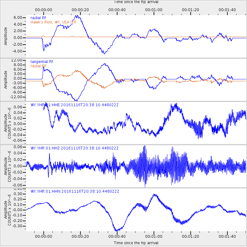
YHR Hawk's Rest, WY, USA - Earthquake Result Viewer
*The percent match for this event was below the threshold and hence no stack was calculated.
| Earthquake location: |
South Of Fiji Islands |
| Earthquake latitude/longitude: |
-22.1/-177.6 |
| Earthquake time(UTC): |
2016/11/16 (321) 20:26:15 GMT |
| Earthquake Depth: |
305 km |
| Earthquake Magnitude: |
5.5 MB |
| Earthquake Catalog/Contributor: |
NEIC PDE/NEIC COMCAT |
|
| Network: |
WY Yellowstone Wyoming Seismic Network |
| Station: |
YHR Hawk's Rest, WY, USA |
| Lat/Lon: |
44.11 N/110.08 W |
| Elevation: |
2976 m |
|
| Distance: |
90.3 deg |
| Az: |
41.74 deg |
| Baz: |
238.968 deg |
| Ray Param: |
$rayparam |
*The percent match for this event was below the threshold and hence was not used in the summary stack. |
|
| Radial Match: |
39.178234 % |
| Radial Bump: |
400 |
| Transverse Match: |
38.663033 % |
| Transverse Bump: |
400 |
| SOD ConfigId: |
1858631 |
| Insert Time: |
2016-11-30 20:33:03.223 +0000 |
| GWidth: |
2.5 |
| Max Bumps: |
400 |
| Tol: |
0.001 |
|
Signal To Noise
| Channel | StoN | STA | LTA |
| WY:YHR:01:HHZ:20161116T20:38:10.448022Z | 1.4186821 | 1.2568489E-8 | 8.8592715E-9 |
| WY:YHR:01:HHN:20161116T20:38:10.448022Z | 1.8402408 | 2.7339698E-7 | 1.4856586E-7 |
| WY:YHR:01:HHE:20161116T20:38:10.448022Z | 1.405222 | 4.1418904E-8 | 2.9474988E-8 |
| Arrivals |
| Ps | |
| PpPs | |
| PsPs/PpSs | |


