You are here: Home > Network List > TA - USArray Transportable Network (new EarthScope stations) Stations List
> Station J26L Joseph Creek, AK, USA > Earthquake Result Viewer
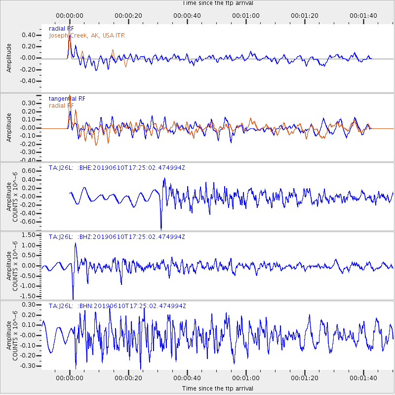
J26L Joseph Creek, AK, USA - Earthquake Result Viewer
*The percent match for this event was below the threshold and hence no stack was calculated.
| Earthquake location: |
Mariana Islands Region |
| Earthquake latitude/longitude: |
17.4/147.8 |
| Earthquake time(UTC): |
2019/06/10 (161) 17:14:53 GMT |
| Earthquake Depth: |
22 km |
| Earthquake Magnitude: |
5.4 Mww |
| Earthquake Catalog/Contributor: |
NEIC PDE/us |
|
| Network: |
TA USArray Transportable Network (new EarthScope stations) |
| Station: |
J26L Joseph Creek, AK, USA |
| Lat/Lon: |
64.50 N/143.56 W |
| Elevation: |
1144 m |
|
| Distance: |
65.3 deg |
| Az: |
26.353 deg |
| Baz: |
258.284 deg |
| Ray Param: |
$rayparam |
*The percent match for this event was below the threshold and hence was not used in the summary stack. |
|
| Radial Match: |
67.73784 % |
| Radial Bump: |
400 |
| Transverse Match: |
72.05202 % |
| Transverse Bump: |
400 |
| SOD ConfigId: |
18369291 |
| Insert Time: |
2019-06-24 17:21:07.241 +0000 |
| GWidth: |
2.5 |
| Max Bumps: |
400 |
| Tol: |
0.001 |
|
Signal To Noise
| Channel | StoN | STA | LTA |
| TA:J26L: :BHZ:20190610T17:25:02.474994Z | 4.8359447 | 5.2030936E-7 | 1.0759209E-7 |
| TA:J26L: :BHN:20190610T17:25:02.474994Z | 1.1218349 | 1.0484692E-7 | 9.346021E-8 |
| TA:J26L: :BHE:20190610T17:25:02.474994Z | 2.7448475 | 2.683259E-7 | 9.77562E-8 |
| Arrivals |
| Ps | |
| PpPs | |
| PsPs/PpSs | |


