You are here: Home > Network List > TA - USArray Transportable Network (new EarthScope stations) Stations List
> Station R33M Jennings River, BC, CAN > Earthquake Result Viewer
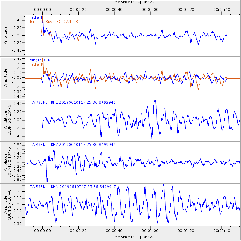
R33M Jennings River, BC, CAN - Earthquake Result Viewer
*The percent match for this event was below the threshold and hence no stack was calculated.
| Earthquake location: |
Mariana Islands Region |
| Earthquake latitude/longitude: |
17.4/147.8 |
| Earthquake time(UTC): |
2019/06/10 (161) 17:14:53 GMT |
| Earthquake Depth: |
22 km |
| Earthquake Magnitude: |
5.4 Mww |
| Earthquake Catalog/Contributor: |
NEIC PDE/us |
|
| Network: |
TA USArray Transportable Network (new EarthScope stations) |
| Station: |
R33M Jennings River, BC, CAN |
| Lat/Lon: |
59.39 N/130.97 W |
| Elevation: |
1437 m |
|
| Distance: |
70.8 deg |
| Az: |
32.388 deg |
| Baz: |
271.669 deg |
| Ray Param: |
$rayparam |
*The percent match for this event was below the threshold and hence was not used in the summary stack. |
|
| Radial Match: |
58.897213 % |
| Radial Bump: |
393 |
| Transverse Match: |
41.70196 % |
| Transverse Bump: |
351 |
| SOD ConfigId: |
18369291 |
| Insert Time: |
2019-06-24 17:21:45.800 +0000 |
| GWidth: |
2.5 |
| Max Bumps: |
400 |
| Tol: |
0.001 |
|
Signal To Noise
| Channel | StoN | STA | LTA |
| TA:R33M: :BHZ:20190610T17:25:36.849994Z | 2.65368 | 3.2096986E-7 | 1.2095273E-7 |
| TA:R33M: :BHN:20190610T17:25:36.849994Z | 0.77958786 | 5.0262052E-8 | 6.4472594E-8 |
| TA:R33M: :BHE:20190610T17:25:36.849994Z | 2.276794 | 1.7363858E-7 | 7.626451E-8 |
| Arrivals |
| Ps | |
| PpPs | |
| PsPs/PpSs | |


