You are here: Home > Network List > US - United States National Seismic Network Stations List
> Station CBKS Cedar Bluff, Kansas, USA > Earthquake Result Viewer
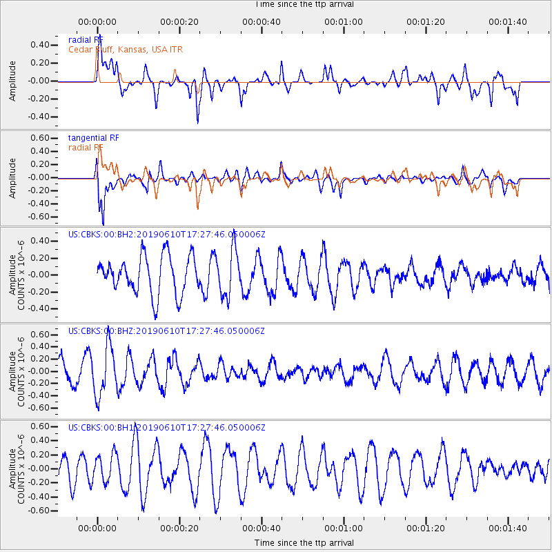
CBKS Cedar Bluff, Kansas, USA - Earthquake Result Viewer
*The percent match for this event was below the threshold and hence no stack was calculated.
| Earthquake location: |
Mariana Islands Region |
| Earthquake latitude/longitude: |
17.4/147.8 |
| Earthquake time(UTC): |
2019/06/10 (161) 17:14:53 GMT |
| Earthquake Depth: |
22 km |
| Earthquake Magnitude: |
5.4 Mww |
| Earthquake Catalog/Contributor: |
NEIC PDE/us |
|
| Network: |
US United States National Seismic Network |
| Station: |
CBKS Cedar Bluff, Kansas, USA |
| Lat/Lon: |
38.81 N/99.74 W |
| Elevation: |
677 m |
|
| Distance: |
95.7 deg |
| Az: |
46.504 deg |
| Baz: |
297.553 deg |
| Ray Param: |
$rayparam |
*The percent match for this event was below the threshold and hence was not used in the summary stack. |
|
| Radial Match: |
59.34353 % |
| Radial Bump: |
400 |
| Transverse Match: |
64.03643 % |
| Transverse Bump: |
400 |
| SOD ConfigId: |
18369291 |
| Insert Time: |
2019-06-24 17:22:18.084 +0000 |
| GWidth: |
2.5 |
| Max Bumps: |
400 |
| Tol: |
0.001 |
|
Signal To Noise
| Channel | StoN | STA | LTA |
| US:CBKS:00:BHZ:20190610T17:27:46.050006Z | 3.3698177 | 4.1459515E-7 | 1.2303192E-7 |
| US:CBKS:00:BH1:20190610T17:27:46.050006Z | 1.1787343 | 1.9722091E-7 | 1.6731585E-7 |
| US:CBKS:00:BH2:20190610T17:27:46.050006Z | 1.2438785 | 2.7498183E-7 | 2.2106808E-7 |
| Arrivals |
| Ps | |
| PpPs | |
| PsPs/PpSs | |


