You are here: Home > Network List > US - United States National Seismic Network Stations List
> Station HAWA Hanford, Washington, USA > Earthquake Result Viewer
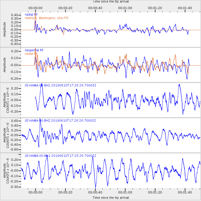
HAWA Hanford, Washington, USA - Earthquake Result Viewer
*The percent match for this event was below the threshold and hence no stack was calculated.
| Earthquake location: |
Mariana Islands Region |
| Earthquake latitude/longitude: |
17.4/147.8 |
| Earthquake time(UTC): |
2019/06/10 (161) 17:14:53 GMT |
| Earthquake Depth: |
22 km |
| Earthquake Magnitude: |
5.4 Mww |
| Earthquake Catalog/Contributor: |
NEIC PDE/us |
|
| Network: |
US United States National Seismic Network |
| Station: |
HAWA Hanford, Washington, USA |
| Lat/Lon: |
46.39 N/119.53 W |
| Elevation: |
364 m |
|
| Distance: |
79.4 deg |
| Az: |
44.693 deg |
| Baz: |
284.022 deg |
| Ray Param: |
$rayparam |
*The percent match for this event was below the threshold and hence was not used in the summary stack. |
|
| Radial Match: |
53.141663 % |
| Radial Bump: |
400 |
| Transverse Match: |
52.495075 % |
| Transverse Bump: |
400 |
| SOD ConfigId: |
18369291 |
| Insert Time: |
2019-06-24 17:22:20.760 +0000 |
| GWidth: |
2.5 |
| Max Bumps: |
400 |
| Tol: |
0.001 |
|
Signal To Noise
| Channel | StoN | STA | LTA |
| US:HAWA:00:BHZ:20190610T17:26:26.70003Z | 2.9177723 | 3.2187467E-7 | 1.10315206E-7 |
| US:HAWA:00:BH1:20190610T17:26:26.70003Z | 0.7088094 | 1.10183116E-7 | 1.5544816E-7 |
| US:HAWA:00:BH2:20190610T17:26:26.70003Z | 0.8595145 | 8.8633584E-8 | 1.0312053E-7 |
| Arrivals |
| Ps | |
| PpPs | |
| PsPs/PpSs | |


