You are here: Home > Network List > US - United States National Seismic Network Stations List
> Station WMOK Wichita Mountains, Oklahoma, USA > Earthquake Result Viewer
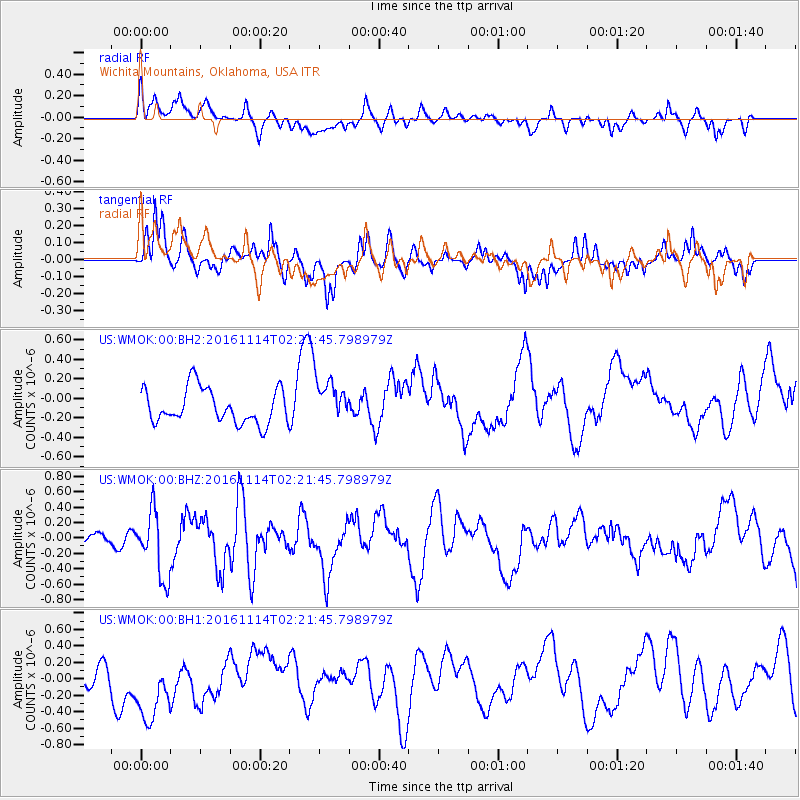
WMOK Wichita Mountains, Oklahoma, USA - Earthquake Result Viewer
*The percent match for this event was below the threshold and hence no stack was calculated.
| Earthquake location: |
Rat Islands, Aleutian Islands |
| Earthquake latitude/longitude: |
51.1/178.8 |
| Earthquake time(UTC): |
2016/11/14 (319) 02:12:17 GMT |
| Earthquake Depth: |
34 km |
| Earthquake Magnitude: |
5.6 MWW, 5.0 ML, 5.4 ML |
| Earthquake Catalog/Contributor: |
NEIC PDE/NEIC COMCAT |
|
| Network: |
US United States National Seismic Network |
| Station: |
WMOK Wichita Mountains, Oklahoma, USA |
| Lat/Lon: |
34.74 N/98.78 W |
| Elevation: |
486 m |
|
| Distance: |
59.4 deg |
| Az: |
71.501 deg |
| Baz: |
313.41 deg |
| Ray Param: |
$rayparam |
*The percent match for this event was below the threshold and hence was not used in the summary stack. |
|
| Radial Match: |
44.573376 % |
| Radial Bump: |
400 |
| Transverse Match: |
62.532604 % |
| Transverse Bump: |
359 |
| SOD ConfigId: |
1858631 |
| Insert Time: |
2016-12-01 02:51:46.538 +0000 |
| GWidth: |
2.5 |
| Max Bumps: |
400 |
| Tol: |
0.001 |
|
Signal To Noise
| Channel | StoN | STA | LTA |
| US:WMOK:00:BHZ:20161114T02:21:45.798979Z | 1.582781 | 4.2394078E-7 | 2.678455E-7 |
| US:WMOK:00:BH1:20161114T02:21:45.798979Z | 2.221525 | 5.2533466E-7 | 2.3647479E-7 |
| US:WMOK:00:BH2:20161114T02:21:45.798979Z | 1.2359204 | 2.2050808E-7 | 1.784161E-7 |
| Arrivals |
| Ps | |
| PpPs | |
| PsPs/PpSs | |


